place

Camp H. M. Smith

1941 establishments in HawaiiAiea, HawaiiBuildings and structures in Honolulu County, HawaiiHistoric American Buildings Survey in HawaiiMilitary command and control installations
Military facilities in HawaiiMilitary headquarters in the United StatesUnited States Marine Corps bases
CMC and SMMC visit MARFORPAC 150319 M WQ429 063

Camp H. M. Smith is a United States Marine Corps installation in the Halawa census-designated place on the island of Oahu, Hawaii, near the community of Halawa (ha-LA-va) Heights. It is the headquarters of the United States Indo-Pacific Command (INDOPACOM), Special Operations Command Pacific, and Marine Forces Pacific, the Marine service component command of INDOPACOM. The camp, originally the Aiea Naval Hospital, was named for General Holland McTyeire Smith, the first commanding general of Fleet Marine Force Pacific, on June 8, 1955. The initials H. M. also stood for his nickname which was "Howling Mad" referring to his temper and given to him by his Marines.

Excerpt from the Wikipedia article Camp H. M. Smith (License: CC BY-SA 3.0, Authors, Images).

Camp H. M. Smith
Elrod Road, Waipahu Hālawa Heights

Geographical coordinates (GPS) Address Nearby Places
placeShow on map

Wikipedia: Camp H. M. SmithContinue reading on Wikipedia

Geographical coordinates (GPS)

Latitude Longitude
N 21.385833333333 ° E -157.90638888889 °
placeShow on map

Address

Elrod Road

Elrod Road
96859 Waipahu, Hālawa Heights
Hawaii, United States
mapOpen on Google Maps

CMC and SMMC visit MARFORPAC 150319 M WQ429 063
Share experience

Nearby Places

Keaīwa Heiau State Recreation Area

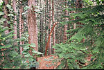
Keaīwa Heiau State Recreation Area is the ruins of a temple (Heiau in the Hawaiian language) at the summit of a hill and neighborhood called ʻAiea Heights on Oʻahu, Hawaiʻi. The recreation area includes camping facilities and a 4.8-mile (7.7 km) trail. It also offers clear views of Pearl Harbor. The high point of Puu Uau is about halfway down the trail, where native ohia lehua and koa trees may be viewed. The remains of a military plane that crashed in 1944 can also be seen along the trail. The hike is not particularly difficult, however it does include one quite steep switchback stretch and can be extremely muddy if it has just rained. Allow for around 2.5 hours of easy strolling. A possible translation of Keaʻiwa would be mysterious, incomprehensible. It is believed that this name was given in reference to the healing powers of the plants that no one could really explain. In addition, Keaiwa Heiau may have also been known as a "Heiau Hoʻola," or the healing or life-giving heiau according to native Hawaiian scholar Mary Kawena Pukui.Foresters replanted most of this area in the late 1920s. The lemon eucalyptus trees give forth a mild citrus scent in the air. The trail's lower end is marked by stands of Norfolk Island pine trees. Pu'u Uau, the trail's high point around halfway along the length, is surrounded by native koa and ohi'a trees. There is also wreckage of a B-24 aircraft that went down in 1944. The name "Keʻaiwa" means "strange" or "incomprehensible" in Hawaiian. Perhaps the name refers to the idea that the powers of the kahuna and the plants employed in healing are unfathomable.Erected sometime in the 16th century by Kakuhihewa, the 15th Aliʻi ʻAimoku, or ruling chief, of Oahu, the 100 feet (24 m) by 160 feet (49 m) stone temple had walls averaging 4 ft in height and 5 ft in width. The walls consisted of numerous evenly faced one foot stones that are filled with rubble. Abundant medicinal herbs in the area were used by kahuna as a type of ancient herbal clinic. The kahuna would also train haumana (students) interested in the art of laʻau lapaʻau (healing medicine). The kahuna would also train students in the practice of praying, fasting, and medicinal healing using the neighboring plants. The reputed healing powers of the surrounding plants still draws visitors who leave temple offerings, hoping to experience medicinal benefits.Most of the trees in the area were replanted during the early 20th century. Although native species can be found at the highpoint of the trail. The remnants of a military airplane that crashed onto the area in 1993 can also be seen from the trail.The site provides a map for the 4.5 miles (7.2 km) Aiea Loop Trail. Several varieties of trees and other vegetation are enjoyed by visitors who make the trek.

Hālawa station
Hālawa station

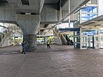
Hālawa station (also known as Aloha Stadium station) is a Skyline metro station in Hālawa, Hawaiʻi, serving Aloha Stadium, ʻAiea, Salt Lake, and Moanalua. The station is located alongside Kamehameha Highway above its intersection with Salt Lake Boulevard. It serves as the eastern terminus of the current rail system and opened on June 30, 2023. The station has a 590-space park and ride lot.As the eastern terminus, buses provide services along the future right of way via the adjacent bus bay. TheBus Route A CityExpress! provides express service between Hālawa station, Downtown Honolulu, the Ala Moana Center, and the University of Hawaiʻi at Mānoa every 10 minutes, timed with the arrival of trains. Route 1L provides limited stop service between this station and East Honolulu via King Street and Waiʻalae Avenue, including stops at Middle Street–Kalihi Transit Center and Kahala Mall. Routes 20 and PH8 provide service between this station and Joint Base Pearl Harbor–Hickam, with route 20 continuing on to the Daniel K. Inouye International Airport, Downtown Honolulu, and Waikīkī.In Hawaiian, "hālawa" means "curve" and is the name of the ahupuaʻa in which it is located, the easternmost in the ʻEwa District. The Hawaiian Station Name Working Group proposed Hawaiian names for the nine rail stations on the ʻEwa end of the rail system (stations west of and including Aloha Stadium) in November 2017, and HART adopted the proposed names on February 22, 2018.