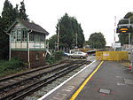
Sturry
City of CanterburyCivil parishes in KentVillages in Kent

Sturry is a village on the Great Stour river situated 5 kilometres (3.1 mi) northeast of Canterbury in Kent. Its large civil parish incorporates several hamlets and, until April 2019, the former mining village of Hersden.
Excerpt from the Wikipedia article Sturry (License: CC BY-SA 3.0, Authors, Images).Sturry
Wildwood Road, Canterbury
Geographical coordinates (GPS) Address Nearby Places Show on map
Geographical coordinates (GPS)
| Latitude | Longitude |
|---|---|
| N 51.3036 ° | E 1.1211 ° |
Address
Wildwood Road
Wildwood Road
CT2 0JT Canterbury
England, United Kingdom
Open on Google Maps


