Calcott, Kent
City of CanterburyHamlets in KentKent geography stubs
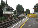
Calcott is a hamlet in Sturry parish, in the Canterbury District of the English county of Kent. It lies on the A291 road, about 1+1⁄2 miles (2.4 km) north of Sturry and 3 miles (5 km) south of Herne Bay.
Excerpt from the Wikipedia article Calcott, Kent (License: CC BY-SA 3.0, Authors).Calcott, Kent
Herne Bay Road, Canterbury
Geographical coordinates (GPS) Address Nearby Places Show on map
Geographical coordinates (GPS)
| Latitude | Longitude |
|---|---|
| N 51.3212 ° | E 1.1187 ° |
Address
Herne Bay Road
Herne Bay Road
CT3 4ND Canterbury
England, United Kingdom
Open on Google Maps


