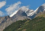
Alphubel
Alpine four-thousandersFour-thousanders of SwitzerlandMountains of SwitzerlandMountains of ValaisMountains of the Alps ... and 1 more
Pennine Alps

The Alphubel (4,206 m) is a mountain of the Swiss Pennine Alps, located between the valleys of Zermatt and Saas in the canton of Valais. It is part of the Allalin Group, a subgroup of the Mischabel Group, which culminates at the Dom (4,545 m). The summit of the Alphubel consists of a large ice-covered plateau, part of the Fee Glacier on its east side. The west side of the mountain is more rocky and much steeper. It overlooks the Weingartensee. The nearest settlements are Täsch (north of Zermatt) and Saas-Fee.
Excerpt from the Wikipedia article Alphubel (License: CC BY-SA 3.0, Authors, Images).Alphubel
Geographical coordinates (GPS) Address Website Nearby Places Show on map
Geographical coordinates (GPS)
| Latitude | Longitude |
|---|---|
| N 46.062938888889 ° | E 7.8639111111111 ° |
Address
Saas-Fee
3906
Wallis, Switzerland
Open on Google Maps


