Erith

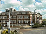
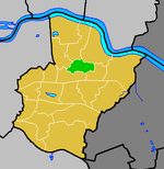
Erith ( (listen)) is an area in south-east London, England, 13.3 miles (21.4 km) east of Charing Cross. Before the creation of Greater London in 1965, it was in the historical county of Kent. Since 1965 it has formed part of the London Borough of Bexley. It lies north-east of Bexleyheath and north-west of Dartford, on the south bank of the River Thames. The town centre has been modernised with further dwellings added since 1961. The curved riverside high street has three listed buildings, including the Church of England church and the Carnegie Building. Erith otherwise consists mainly of suburban housing. It is linked to central London and Kent by rail and to Thamesmead by a dual carriageway. It has the longest pier in London, and retains a coastal environment with salt marshes alongside industrial land.
Excerpt from the Wikipedia article Erith (License: CC BY-SA 3.0, Authors, Images).Erith
Queens Road, London North End (London Borough of Bexley)
Geographical coordinates (GPS) Address Nearby Places Show on map
Geographical coordinates (GPS)
| Latitude | Longitude |
|---|---|
| N 51.48 ° | E 0.1778 ° |
Address
Queens Road
Queens Road
DA8 1FB London, North End (London Borough of Bexley)
England, United Kingdom
Open on Google Maps


