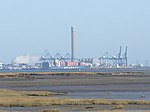
Yantlet

Yantlet Creek is the creek draining into the River Thames that separated the Isle of Grain from the Hoo peninsula. It once connected the River Medway with the River Thames and made the Isle of Grain a true island. The creek silted up and now drains the area of The Isle of Grain and Allhallows Marshes. A monument known as the London Stone is located at its mouth and marks the limit of the City of London's ownership of the Thames.Yantlet gives its name to the Yantlet Reach on the Thames, and in its time has been used as point where the river became the estuary. The Yantlet Creek area is designated a special landscape area in the Medway Local Plan. It is also part of the South Thames Estuary and Marshes special protection area (SPA), and within the Natural Area of the Greater Thames Estuary and Site of Special Scientific Interest (SSSI).
Excerpt from the Wikipedia article Yantlet (License: CC BY-SA 3.0, Authors, Images).Yantlet
Peat Way,
Geographical coordinates (GPS) Address Nearby Places Show on map
Geographical coordinates (GPS)
| Latitude | Longitude |
|---|---|
| N 51.470605 ° | E 0.670956 ° |
Address
Peat Way
ME3 0BG , Isle of Grain
England, United Kingdom
Open on Google Maps


