place

Kyle Bay

Bays of New South WalesGeorges River CouncilSuburbs of SydneyUse Australian English from February 2015
KyleBay2
KyleBay2

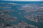
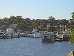
Kyle Bay is a suburb in southern Sydney, in the state of New South Wales, Australia. Kyle Bay is 19 kilometres south of the Sydney central business district, in the local government area of the Georges River Council and is part of the St George area. Kyle Bay takes its name from the bay that sits on the northern shore of the Georges River. It is a tiny, affluent, picturesque suburb around this bay and Harness Cask Point. Kyle Bay is surrounded by the suburbs of Blakehurst, South Hurstville and Connells Point. Kangaroo Point sits on the opposite bank of the Georges River. It is 7 km west of Botany Bay and 12 km north-west of the Cronulla surfing beaches. This leafy suburb is graced with scenic riverside parks and reserves including Merriman Reserve and Donnelly Reserve. Kyle Bay and Harness Cask Point are natural formations.

Excerpt from the Wikipedia article Kyle Bay (License: CC BY-SA 3.0, Authors, Images).

Kyle Bay
Terry Street, Sydney Connells Point

Geographical coordinates (GPS) Address Nearby Places
placeShow on map

Wikipedia: Kyle BayContinue reading on Wikipedia

Geographical coordinates (GPS)

Latitude Longitude
N -33.989166666667 ° E 151.095 °
placeShow on map

Address

Terry Street

Terry Street
2221 Sydney, Connells Point
New South Wales, Australia
mapOpen on Google Maps

KyleBay2
KyleBay2
Share experience

Nearby Places

Caravan Head Bushland Reserve

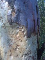
Caravan Head Bushland Reserve is a reserve approximately 2.2ha located in Sutherland Shire, southern Sydney, in the state of New South Wales, Australia. The reserve is bounded by Caravan Head Road, Cook Road and private property located in the northern part of the suburb of Oyster Bay. It consists of two parcels of land, Lot 9 Deposited Plan 203088 owned by the State of NSW and Lot 31 DP 203088 owned by Sutherland Shire Council. The land is zoned E2 - Environmental Conservation under Sutherland Shire Local Environmental Plan 2015.It contains a diverse array of native ridgetop native vegetation due to the fact the land was put aside for a proposed school that was never built eventually its ownership was transferred and a development proposal was put forward in the 1990s after local uproar and political support the land was bought by the state government and it was turned into a bushland reserve. During the reserves early history it was severely damaged when the centre of the site was gutted of vegetation and bike tracks cut the remaining vegetation into smaller fragments. After over a decade of regeneration efforts by the local Bushcare Group of volunteer members the site has been nearly restored to its former glory even though it will always need constant attention into the future. On the eastern side of the reserve a dense callitris woodland exists Callitris rhomboidea (Port Jackson pine) under which grow extensive native pasture and an open shrubbery. The majority of the site consists of semi-disturbed woodland dominated by Corymbia gummifera (red bloodwoods); Angophora costata (Sydney red gum) and Eucalyptus haemastoma (scribbly gums). The majority of the site is on a very slight slope with few exposed rock and deep sandy soils except for the northern edge where massive boulders of Sydney sandstone protrude from a more steep hillside which has acted to preserve a more diverse groundcover. The southern edge and the center of the site have all been re-vegetated by Bushcare to a near-natural state with a variety of species and other species from the surrounding bushland are re-colonising these areas. A total of nearly 150 species of native flora have been recorded in the reserve.