Oatley Bay
Bays of New South WalesGeorges River CouncilUse Australian English from March 2022

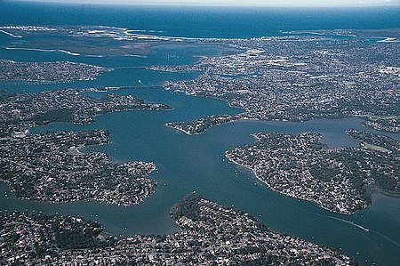
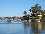
Oatley Bay is a bay located in the Georges River Council, surrounded by the suburbs of Oatley, Hurstville Grove and Connells Point. The bay is part of the Georges River waterway. It is popular for cycling, walking, children's play, picnics and barbecues, and is also used for boating. The area around the bay is built-up. Reserves and parks in the bay include: Poulton Park, Redin Place Reserve, Oatley Point Reserve, Oatley Pleasure Grounds and Moore Reserve.The bay has a shallow depth, averaging about 1.5 metres, and is the end point for all run-off from the approximately 468-504 hectare Oatley Bay catchment. There is a ramp for access by boat.
Excerpt from the Wikipedia article Oatley Bay (License: CC BY-SA 3.0, Authors, Images).Oatley Bay
Rosa Street, Sydney Oatley
Geographical coordinates (GPS) Address Nearby Places Show on map
Geographical coordinates (GPS)
| Latitude | Longitude |
|---|---|
| N -33.983333333333 ° | E 151.08333333333 ° |
Address
Rosa Street
Rosa Street
2223 Sydney, Oatley
New South Wales, Australia
Open on Google Maps


