Raywell
East Riding of Yorkshire geography stubsHamlets in the East Riding of YorkshireScouting stubsUse British English from June 2015

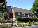
Raywell is a hamlet in the East Riding of Yorkshire, England. It is situated approximately 7 miles (11 km) north-west of Hull city centre and 2 miles (3.2 km) north of Swanland. It is located on the crossroads of Westfields Road and Riplingham Road. These roads link Riplingham (South Cave), Eppleworth (Cottingham) and Kirk Ella. Raywell forms part of the civil parish of Skidby. It consists of a farm and an old manor house. It is noted as a local Scout/Girl guides site. Locally it is also noted because of a number of walks that start there.
Excerpt from the Wikipedia article Raywell (License: CC BY-SA 3.0, Authors, Images).Raywell
Riplingham Road,
Geographical coordinates (GPS) Address Website Nearby Places Show on map
Geographical coordinates (GPS)
| Latitude | Longitude |
|---|---|
| N 53.764247 ° | E -0.499941 ° |
Address
Raywell Park
Riplingham Road
HU16 5YR , Skidby
England, United Kingdom
Open on Google Maps


