Riplingham
Deserted medieval villages in the East Riding of YorkshireEast Riding of Yorkshire geography stubsHamlets in the East Riding of YorkshireOpenDomesdayUse British English from June 2015

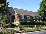
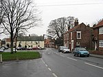
Riplingham is a hamlet in the East Riding of Yorkshire, England. It is situated approximately 7 miles (11 km) south-west of Beverley and 3 miles (4.8 km) east of South Cave, on the crossroads that link (broadly speaking) South Cave, Welton, North Newbald and Raywell. Riplingham is part in the civil parish of Rowley and part in the civil parish of South Cave. It has no shops, but does have a good view of Hull, and the surrounding area, including the Humber estuary and its south bank. It is also the site of a medieval village. In 1955 a Ham class minesweeper HMS Riplingham was named after the village.
Excerpt from the Wikipedia article Riplingham (License: CC BY-SA 3.0, Authors, Images).Riplingham
Westoby Lane,
Geographical coordinates (GPS) Address Nearby Places Show on map
Geographical coordinates (GPS)
| Latitude | Longitude |
|---|---|
| N 53.774846 ° | E -0.54008 ° |
Address
Westoby Lane
HU15 1QU
England, United Kingdom
Open on Google Maps


