West Ella

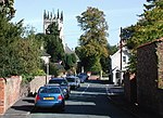
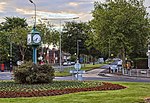
West Ella is a small village in the civil parish of Kirk Ella west of Kirk Ella settlement, within the East Riding of Yorkshire, England, on the eastern edge of the Yorkshire Wolds, approximately 6 miles (10 km) west of the city of Kingston upon Hull. The village lies on West Ella Road, between Kirk Ella and Swanland – it was beautified by the owners the Sykes family in the 19th century, and as a consequence much of the area is now a conservation area, with many listed buildings. In the two decades after the end of the Second World War the village expanded, more than doubling the housing stock, mainly high quality detached dwellings, with much of the new housing along an additional road, Elveley Drive, running north. West Ella is considered to be one of the most exclusive and desirable villages to live in the East Riding of Yorkshire.
Excerpt from the Wikipedia article West Ella (License: CC BY-SA 3.0, Authors, Images).West Ella
Chapel Lane,
Geographical coordinates (GPS) Address Nearby Places Show on map
Geographical coordinates (GPS)
| Latitude | Longitude |
|---|---|
| N 53.749728 ° | E -0.47134 ° |
Address
Chapel Lane
Chapel Lane
HU10 7SE
England, United Kingdom
Open on Google Maps


