place

Little Bytham

Civil parishes in LincolnshireGeographic coordinate listsLists of coordinatesSouth Kesteven DistrictUse British English from January 2014
Villages in Lincolnshire
St Medardus & St Gildardus

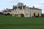
Little Bytham is a village and civil parish in the South Kesteven district of Lincolnshire, England. The population of the civil parish at the 2011 census was 384. It lies on the B1176 road, 4 miles (6 km) south from Corby Glen and 6 miles (10 km) north from Stamford . The East Coast Main Line railway cuts through the eastern side of the village over viaducts. On the edge of Little Bytham to the east is the West Glen River. Further east lie Witham on the Hill and Grimsthorpe Castle estate. To the west is Castle Bytham and, over the Rutland county boundary, is Clipsham. Careby is just to the south. The name 'Bytham' is first recorded in 1067 (as a monastery that rapidly translated to Vaudey Abbey), and comes from the Old English word bythme meaning Valley bottom, broad valley.

Excerpt from the Wikipedia article Little Bytham (License: CC BY-SA 3.0, Authors, Images).

Little Bytham
High Street, South Kesteven Little Bytham

Geographical coordinates (GPS) Address Nearby Places
placeShow on map

Wikipedia: Little BythamContinue reading on Wikipedia

Geographical coordinates (GPS)

Latitude Longitude
N 52.75003 ° E -0.501121 °
placeShow on map

Address

High Street

High Street
NG33 4QJ South Kesteven, Little Bytham
England, United Kingdom
mapOpen on Google Maps

St Medardus & St Gildardus
Share experience

Nearby Places

St Medardus and St Gildardus Church, Little Bytham

The church of St Medardus and St Gildardus in Little Bytham, Lincolnshire, England, is a Grade I listed building. It is dedicated to two 6th-century French saints, St Medard and St Gildard (or Medardus and Gildardus); the dedication is unique in the UK. Virtually unknown in Britain, St Medard is still well known in France, with at least 25 towns or villages named after him (as St Médard or St Méard). Gildard, thought to be his brother, is less well known. The village fête is held annually on or near St Medard's feast day, 8 June. The earliest parts of the building are some Anglo-Saxon "long-and-short" stonework, visible externally at the southeast and southwest corners (quoins) of the nave. The church also has several Romanesque details dating from the Norman era, including a Priest's Door ("uncommonly ornate", according to Nikolaus Pevsner) with a finely carved tympanum; the empty circular niche in the tympanum is said to have held a relic; the birds in roundels to either side are probably eagles, as one is legendarily supposed to have sheltered Medard from the rain. Also Norman are the plain, undecorated arch into the tower, and the north door (late 12th century). The south aisle and the upper parts of the tower and spire are 13th century work; the intersecting tracery of the east window of the south aisle shows that it is slightly later, dating from around 1300, as does the nearby piscina. The chancel arch is probably also from the late 13th century, and the double piscina in the chancel may be of a similar age. The Easter Sepulchre in the chancel is in the slightly later (Decorated) style, but is a fairly crude example. A finely sculpted capital depicting a Green Man surrounded by oak leaves, similar to examples at nearby Kirkby Underwood and Greatford, also dates from c.1300. It is no longer in position, having been built into a wall, face inwards, and rediscovered during later restoration work.The stone base of the pulpit is dated 1590, and has a Latin inscription Orate et parate ("Pray and prepare"). Pevsner mistakenly gives this as Orate et Arate. The Listed Building entry is taken from Pevsner, with the same error.The churchyard contains the war grave of a Royal Engineers soldier of the First World War.

Counthorpe
Counthorpe

Counthorpe is a hamlet in the civil parish of Counthorpe and Creeton in the South Kesteven district of Lincolnshire, England. It adjoins the hamlet of Creeton and lies 5 miles (8 km) south-west from Bourne and 3 miles (5 km) south from Corby Glen, and on the River Glen. In the Domesday account Counthorpe is written as "Cudetorp". Before the Conquest lordship was held by Earl Morcar; after, Drogo de la Beuvrière became Tenant-in-chief.Counthorpe shares the Grade I listed Anglican parish church at Creeton, dedicated to St Peter. The church is of late Decorated style. A restoration of 1851 discovered the arches and piers of a former Norman aisle. The church holds a chained bible from 1611. Two examples of Saxon crosses stand in the churchyard, with 20 stone coffins considered to mark the interment of Cistercian monks of Vallis Dei abbey in the neighbouring parish of Edenham.Counthorpe was formerly a hamlet of Castle Bytham and had, up to the 16th century, its own parochial chapel, but was annexed to Creeton in 1860.Counthorpe is recorded in the 1872 White's Directory as a small village in the parish of Castle Bytham, but which, for ecclesiastical purposes, became on 30 June 1860 united with Creeton. The village was 2 miles (3 km) from Little Bytham railway station. At this time Counthope was a township of 78 people in about 130 acres (0.5 km2) of land divided between three farms; a farmer of one of these, at Counthorpe Lodge, was also a grazier.