Careby Aunby and Holywell
Civil parishes in LincolnshireGeographic coordinate listsLists of coordinatesSouth Kesteven District

Careby Aunby and Holywell is a civil parish in the district of South Kesteven, south-west Lincolnshire, in England. It stretches from the county border with Rutland in the west to the River West Glen in the east. The B1176 road from Corby Glen passes through Careby and on past Aunby toward Stamford. The main London to Scotland railway line passes through the parish, the line upon which Mallard took the speed record for the LNER.The total population in the 2001 census was 146, falling marginally to 143 at the 2011 census. The population in 1801 was 65, and had risen to 133 by 1911 The centre of the parish is near grid reference TF017157
Excerpt from the Wikipedia article Careby Aunby and Holywell (License: CC BY-SA 3.0, Authors, Images).Careby Aunby and Holywell
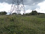
Hollywell Road, South Kesteven Careby Aunby and Holywell
Geographical coordinates (GPS) Address Nearby Places Show on map
Geographical coordinates (GPS)
| Latitude | Longitude |
|---|---|
| N 52.73 ° | E -0.494 ° |
Address
Hollywell Road
Hollywell Road
PE9 4EB South Kesteven, Careby Aunby and Holywell
England, United Kingdom
Open on Google Maps


