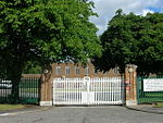
Southburn
East Riding of Yorkshire geography stubsFormer civil parishes in the East Riding of YorkshireOpenDomesdayUse British English from June 2015Villages in the East Riding of Yorkshire

Southburn is a hamlet and former civil parish, now in the parish of Kirkburn, in the East Riding of Yorkshire, England. It is situated in the Yorkshire Wolds just south of the A164 road, approximately 3 miles (4.8 km) south-west of Driffield and 2.5 miles (4 km) north-west of Hutton Cranswick. In 1931 the parish had a population of 116. From 1890 until 1954 Southburn was served by Southburn railway station on the Selby to Driffield Line.
Excerpt from the Wikipedia article Southburn (License: CC BY-SA 3.0, Authors, Images).Southburn
Geographical coordinates (GPS) Address Nearby Places Show on map
Geographical coordinates (GPS)
| Latitude | Longitude |
|---|---|
| N 53.975749 ° | E -0.49243 ° |
Address
YO25 9ED
England, United Kingdom
Open on Google Maps


