place

Bracken on the Wolds

Hamlets in the East Riding of YorkshireUse British English from December 2014
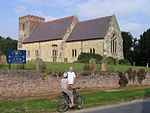
The Minor Road to Bracken geograph.org.uk 2237507

Bracken on the Wolds (or Bracken) is a manor and hamlet in the East Riding of Yorkshire, England. It is situated in the Yorkshire Wolds approximately 1 mile (2 km) north-west of Kilnwick and 2 miles (3 km) north-east of Middleton on the Wolds. It lies less than 1 mile (2 km) east of the A614 road. The manor forms part of the civil parish of Watton. It was formerly a village of greater size with a chapel and garth, which was demolished by 1573, as well as a graveyard. Since the 19th century, it has consisted of several rural estates - namely Horn Hill Farm, Bracken Fold, Bracken Farm and Bracken Burrows. There are woodlands, walking paths, manorial waste and two streams that lie within its boundary - Bracken Beck in the south and an unnamed tributary of Cawkeld Sinks (a small lake in nearby Kilnwick) in the east. A section of the Minster Way crosses through the manor centre, from the south-east near Wedding Wood in Kilnwick to its northern boundary.

Excerpt from the Wikipedia article Bracken on the Wolds (License: CC BY-SA 3.0, Authors, Images).

Geographical coordinates (GPS)

Latitude Longitude
N 53.939422 ° E -0.503643 °
placeShow on map

Address


YO25 9JQ
England, United Kingdom
mapOpen on Google Maps

The Minor Road to Bracken geograph.org.uk 2237507
Share experience

Nearby Places

Bainton, East Riding of Yorkshire

Bainton is a village and civil parish in the East Riding of Yorkshire, England. It is situated approximately 6 miles (10 km) south-west of Driffield on the A614 road. According to the 2011 UK census, Bainton parish had a population of 334, an increase on the 2001 UK census figure of 282. The parish covers an area of 1,608.08 hectares (3,973.7 acres).Bainton was served by Bainton railway station on the Selby to Driffield Line between 1890 and 1954.Bainton Grade I listed Anglican church is dedicated to St Andrew. Pevsner noted that the church was totally rebuilt in the 1330s or 1340s by the rector William de Brocklesby, except for the south-west corner of the chancel with its priest's doorway, which are c. 1300. Until 1715 the tower supported a spire. The font is Norman, and the pews 18th century. A tomb to Sir Edmund de Mauley lies in the south aisle; [de Mauley, Steward to Edward II, died at the Battle of Bannockburn in 1314]. The tomb has an ogee canopy, crocketed gable and flying angels holding the soul of Sir Edmund in a napkin. There is also a brass to Roger Godeale, died 1429. A south porch and vestry were added by Henry Wheatley in 1843, and a restoration carried out by "Fowler of Louth" in 1866. The church's listed rectory, south of the church, is of late Georgian period. According to Pevsner a local tradition connects the rectory's coniferous garden with Paxton The rectory's coach house and stables are also listed buildings.