Sunderlandwick
East Riding of Yorkshire geography stubsOpenDomesdayUse British English from January 2015Villages in the East Riding of Yorkshire

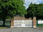
Sunderlandwick is a hamlet in the East Riding of Yorkshire, England. It is situated approximately 1.5 miles (2.4 km) south of Driffield and lies to the west of the A164 road. It forms part of the civil parish of Hutton Cranswick. Sunderlandwick House and its associated stables was designated a Grade II listed building on 15 July 1998.Driffield Golf Club is actually in Sunderlandwick despite the name.
Excerpt from the Wikipedia article Sunderlandwick (License: CC BY-SA 3.0, Authors, Images).Sunderlandwick
Beverley Road,
Geographical coordinates (GPS) Address Phone number Website Nearby Places Show on map
Geographical coordinates (GPS)
| Latitude | Longitude |
|---|---|
| N 53.985592 ° | E -0.453565 ° |
Address
Driffield Golf Course
Beverley Road
YO25 9AD , Hutton Cranswick
England, United Kingdom
Open on Google Maps


