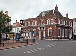
Kelleythorpe
East Riding of Yorkshire geography stubsOpenDomesdayUse British English from December 2014Villages in the East Riding of Yorkshire

Kelleythorpe is a hamlet in the East Riding of Yorkshire, England, it forms part of the civil parish of Kirkburn. It is situated in the Yorkshire Wolds on the A614 road near to its junction with the A164 road. It is situated approximately 1 mile (1.6 km) south-west of Driffield town centre. Kellythorpe Industrial Estate is at the north of the hamlet.
Excerpt from the Wikipedia article Kelleythorpe (License: CC BY-SA 3.0, Authors, Images).Kelleythorpe
Main Street,
Geographical coordinates (GPS) Address Nearby Places Show on map
Geographical coordinates (GPS)
| Latitude | Longitude |
|---|---|
| N 53.993927 ° | E -0.458671 ° |
Address
Main Street
Main Street
YO25 9EY
England, United Kingdom
Open on Google Maps


