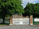
Eastburn, East Riding of Yorkshire
East Riding of Yorkshire geography stubsFormer civil parishes in the East Riding of YorkshireOpenDomesdayUse British English from November 2014Villages in the East Riding of Yorkshire

Eastburn is a hamlet and former civil parish, now in the parish of Kirkburn, in the East Riding of Yorkshire, England. It is situated in the Yorkshire Wolds on the A164 road, approximately 2.5 miles (4 km) south-west of Driffield town centre and 3 miles (5 km) north-west of the village of Hutton Cranswick. In 1931 the parish had a population of 27.
Excerpt from the Wikipedia article Eastburn, East Riding of Yorkshire (License: CC BY-SA 3.0, Authors, Images).Eastburn, East Riding of Yorkshire
Main Street,
Geographical coordinates (GPS) Address Nearby Places Show on map
Geographical coordinates (GPS)
| Latitude | Longitude |
|---|---|
| N 53.987466 ° | E -0.487813 ° |
Address
Main Street
Main Street
YO25 9LH
England, United Kingdom
Open on Google Maps


