Klaaskinderenkerke
Former municipalities of ZeelandFormer populated places in the NetherlandsHistory of Schouwen-DuivelandPopulated places in ZeelandSchouwen-Duiveland ... and 1 more
Zeeland geography stubs

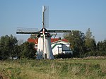
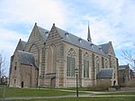
Klaaskinderenkerke (also spelled 'Klaaskinderkerke') is a former village in the Dutch province of Zeeland. The polder Klaaskinderen was flooded on December 14, 1511, and was never reclaimed again. The church of Klaaskinderenkerke disappeared in this flood, and in the 19th century, only a small hamlet was left.The hamlet has now disappeared from the maps. It was located east of the village of Scharendijke. Klaaskinderkerke was a separate municipality until 1813, when it was merged with Duivendijke.
Excerpt from the Wikipedia article Klaaskinderenkerke (License: CC BY-SA 3.0, Authors, Images).Klaaskinderenkerke
Langendijk, Schouwen-Duiveland
Geographical coordinates (GPS) Address Nearby Places Show on map
Geographical coordinates (GPS)
| Latitude | Longitude |
|---|---|
| N 51.740833333333 ° | E 3.8736111111111 ° |
Address
Langendijk
Langendijk
4318 TT Schouwen-Duiveland
Zeeland, Netherlands
Open on Google Maps


