place

Bishopston, Bristol

Areas of BristolEngvarB from October 2013
Bristol bishopston
Bristol bishopston

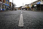
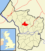
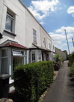
Bishopston is a suburb of the city of Bristol in south west England. Bishopston is around Gloucester Road (A38), the main northern arterial road in the city and Bishop Road.

Excerpt from the Wikipedia article Bishopston, Bristol (License: CC BY-SA 3.0, Authors, Images).

Bishopston, Bristol
Berkeley Road, Bristol Bishopston

Geographical coordinates (GPS) Address Nearby Places
placeShow on map

Wikipedia: Bishopston, BristolContinue reading on Wikipedia

Geographical coordinates (GPS)

Latitude Longitude
N 51.47693 ° E -2.59751 °
placeShow on map

Address

Berkeley Road 91
BS7 8HQ Bristol, Bishopston
England, United Kingdom
mapOpen on Google Maps

Bristol bishopston
Bristol bishopston
Share experience

Nearby Places

Redland Green
Redland Green

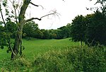
Redland Green is a park in the Bristol suburb of Redland. The park consists of a grassland area and an area of scrub and woodland managed as wildlife habitats by Bristol City Council in partnership with local community groups. A major event each year is Redland May Fair, organised by Redland and Cotham Amenities Society, which has been held annually for over 25 years on the first Monday in May and is opened each year by the Bristol street band The Ambling Band. The green was once farmland, part of the manor of Redland. The name comes from the Latin Rubea Terra and in Norman, la Rede Londe, describing the red soil of the area. The palace of the Bishop of Bristol once stood there, but was destroyed by bombing in World War II. Adjacent to the green are Bristol Lawn Tennis and Squash Club, Redland Green Bowling Club and Redland Green secondary school, and to the north there are allotments. Also adjacent to Redland Green is Redland Parish Church, a Georgian place of worship, built in 1742. It is a Grade I listed building, and was previously the chapel of local manor house, Redland Court, which is why it is not dedicated to any particular saint.The park consists of a grassed area and a larger area of scrub and woodland managed by Bristol City Council, in partnership with local community groups, to encourage biodiversity. The park is open all year round and includes a picnic area with picnic benches and a playground with equipment, including a climbing frame, swings, a roundabout, a sandpit and a zip wire.

Montpelier railway station

Montpelier railway station is on the Severn Beach Line and serves the district of Montpelier in Bristol, England. It is 2.85 miles (4.59 km) from Bristol Temple Meads. Its three letter station code is MTP. The station has a single platform, serving trains in both directions. As of 2015 it is managed by Great Western Railway, which is the third franchise to be responsible for the station since privatisation in 1997. They provide all train services at the station, mainly a train every 30 minutes in each direction. The station was opened on 1 October 1874 as Montpellier (two 'L's) by the Great Western and Midland Railways as part of the Clifton Extension Railway, designed to connect the port of Avonmouth to the national rail network. In February 1888 the station's name changed to Montpelier (one 'L'). The station had two platforms, with the main structures on the southern platform and smaller waiting rooms on the northern platform. In 1903 the station employed 19 staff. Much of the main station building was destroyed by bombing during the Second World War. The Severn Beach Line declined over the latter half of the twentieth century, with passenger numbers falling significantly. Goods services at Montpelier ended in 1965, and all staff were withdrawn in 1967. The line was largely reduced to single track in 1970, with the northern platform abandoned and all trains using the remaining platform. The station building is no longer in railway use. Services had decreased to ten per day each direction by 2005, but have since increased to a train every 30 minutes in each direction.