place

Redland, Bristol

Areas of BristolFormer civil parishes in BristolUse British English from February 2023Wards of Bristol
Bristol redland
Bristol redland

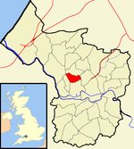
Redland is a neighbourhood in Bristol, England. The neighbourhood is situated between Clifton, Cotham, Bishopston and Westbury Park. The boundaries of the district are not precisely defined, but are generally taken to be Whiteladies Road in the west, the Severn Beach railway line in the south and Cranbrook Road in the east. Redland is also the name of a council ward, which covers a slightly different area. Redland ward extends to the southern part of Bishopston, and does not include the part of Redland south of Redland Road, which is in Cotham ward. Redland is primarily residential, and is known as a popular student accommodation area, particularly with second and third year students from the city's university. Compared to Bristol averages, Redland ward has lower levels of deprivation, relative child poverty, premature mortality and crime. It has higher than average educational attainment, life expectancy, home ownership and car ownership.

Excerpt from the Wikipedia article Redland, Bristol (License: CC BY-SA 3.0, Authors, Images).

Redland, Bristol
Redland Court Road, Bristol Redland

Geographical coordinates (GPS) Address Nearby Places
placeShow on map

Wikipedia: Redland, BristolContinue reading on Wikipedia

Geographical coordinates (GPS)

Latitude Longitude
N 51.47241 ° E -2.60321 °
placeShow on map

Address

Redland Court Road 32
BS6 7AQ Bristol, Redland
England, United Kingdom
mapOpen on Google Maps

Bristol redland
Bristol redland
Share experience

Nearby Places

Redland Green
Redland Green

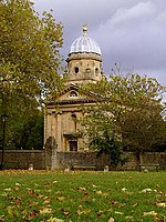
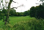
Redland Green is a park in the Bristol suburb of Redland. The park consists of a grassland area and an area of scrub and woodland managed as wildlife habitats by Bristol City Council in partnership with local community groups. A major event each year is Redland May Fair, organised by Redland and Cotham Amenities Society, which has been held annually for over 25 years on the first Monday in May and is opened each year by the Bristol street band The Ambling Band. The green was once farmland, part of the manor of Redland. The name comes from the Latin Rubea Terra and in Norman, la Rede Londe, describing the red soil of the area. The palace of the Bishop of Bristol once stood there, but was destroyed by bombing in World War II. Adjacent to the green are Bristol Lawn Tennis and Squash Club, Redland Green Bowling Club and Redland Green secondary school, and to the north there are allotments. Also adjacent to Redland Green is Redland Parish Church, a Georgian place of worship, built in 1742. It is a Grade I listed building, and was previously the chapel of local manor house, Redland Court, which is why it is not dedicated to any particular saint.The park consists of a grassed area and a larger area of scrub and woodland managed by Bristol City Council, in partnership with local community groups, to encourage biodiversity. The park is open all year round and includes a picnic area with picnic benches and a playground with equipment, including a climbing frame, swings, a roundabout, a sandpit and a zip wire.