Wasserfluh Pass
Canton of St. Gallen geography stubsMountain passes of SwitzerlandMountain passes of the canton of St. Gallen

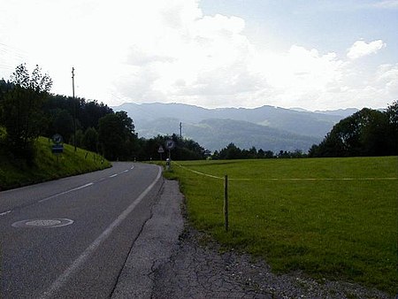
Wasserfluh Pass (el. 848 m.) is a mountain pass in the canton of St. Gallen in Switzerland. It connects Lichtensteig and Brunnadern. The pass road has a maximum grade of 10 percent and an elevation gain of 345 m. Overlooking the pass are the ruins of Neu-Toggenburg castle (47.3296°N 9.1127°E / 47.3296; 9.1127), built by the counts of Toggenburg in the late 12th century (excavated 1937/8).
Excerpt from the Wikipedia article Wasserfluh Pass (License: CC BY-SA 3.0, Authors, Images).Wasserfluh Pass
Wasserfluhstrasse, Neckertal Oberhelfenschwil
Geographical coordinates (GPS) Address Nearby Places Show on map
Geographical coordinates (GPS)
| Latitude | Longitude |
|---|---|
| N 47.325922222222 ° | E 9.1141388888889 ° |
Address
Wasserfluhstrasse
9125 Neckertal, Oberhelfenschwil
St. Gallen, Switzerland
Open on Google Maps


