Cassington
Civil parishes in OxfordshireOpenDomesdayUse British English from August 2015Villages in OxfordshireWest Oxfordshire District

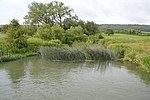
Cassington is a village and civil parish in Oxfordshire about 5 miles (8 km) northwest of Oxford. The village lies on gravel strata about 1⁄2 mile (800 m) from the confluence of the River Evenlode with the River Thames. The parish includes the hamlet of Worton northeast of the village and the site of the former hamlet of Somerford to the south. Somerford seems to have been abandoned early in the 14th century. Cassington is formed of two parts, "upper" and "lower", each with its own village green. The 2011 Census recorded the parish's population as 750.
Excerpt from the Wikipedia article Cassington (License: CC BY-SA 3.0, Authors, Images).Cassington
The Green, West Oxfordshire Cassington
Geographical coordinates (GPS) Address Website Nearby Places Show on map
Geographical coordinates (GPS)
| Latitude | Longitude |
|---|---|
| N 51.793 ° | E -1.343 ° |
Address
Saint Peter's Church of England Primary School
The Green
OX29 4DN West Oxfordshire, Cassington
England, United Kingdom
Open on Google Maps


