Hanbury Street
Jack the RipperSpitalfieldsStreets in the London Borough of Tower HamletsUse British English from October 2013

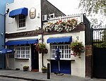
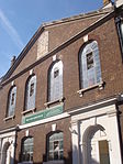
Hanbury Street is a street running from Spitalfields to Whitechapel, London Borough of Tower Hamlets, in the East End of London. It runs east from Commercial Street to the junction of Old Montague Street and Vallance Road at the east end. The eastern section is restricted to pedal cycles and pedestrians only.
Excerpt from the Wikipedia article Hanbury Street (License: CC BY-SA 3.0, Authors, Images).Hanbury Street
Hanbury Street, London Whitechapel
Geographical coordinates (GPS) Address Nearby Places Show on map
Geographical coordinates (GPS)
| Latitude | Longitude |
|---|---|
| N 51.52 ° | E -0.069166666666667 ° |
Address
Hanbury Street 103
E1 5JQ London, Whitechapel
England, United Kingdom
Open on Google Maps


