Brick Lane
Bethnal GreenEthnic enclaves in the United KingdomRestaurant districts and streets in EnglandShoreditchSpitalfields ... and 3 more
Streets in the London Borough of Tower HamletsUse British English from June 2015Whitechapel

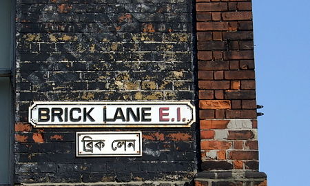
Brick Lane (Bengali: ব্রিক লেন) is a street in the East End of London, in the borough of Tower Hamlets. It runs from Swanfield Street in Bethnal Green in the north, crosses the Bethnal Green Road before reaching the busiest, most commercially active part which runs through Spitalfields, or along its eastern edge. Brick Lane’s southern end is connected to Whitechapel High Street by a short extension called Osborn Street. Today, it is the heart of the country's Bangladeshi community with the vicinity known to some as Banglatown. It is famous for its many curry houses.
Excerpt from the Wikipedia article Brick Lane (License: CC BY-SA 3.0, Authors, Images).Brick Lane
Brick Lane, London Whitechapel
Geographical coordinates (GPS) Address Website Nearby Places Show on map
Geographical coordinates (GPS)
| Latitude | Longitude |
|---|---|
| N 51.521944444444 ° | E -0.071666666666667 ° |
Address
Boiler House
Brick Lane 152
E1 6RU London, Whitechapel
England, United Kingdom
Open on Google Maps


