place

Brick Lane Mosque

18th-century churches in the United Kingdom19th-century synagogues20th-century mosquesBangladeshi diaspora in the United KingdomGrade II* listed buildings in the London Borough of Tower Hamlets
Grade II* listed religious buildings and structuresGrand mosquesInfobox religious building with unknown affiliationReligion in the London Borough of Tower HamletsReligious buildings and structures converted into mosquesSpitalfieldsSunni mosques in London
Brick Lane Mosque2
Brick Lane Mosque2

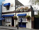
Brick Lane Jamme Masjid (Bengali: ব্রিক লেন জামে মসজিদ, Arabic: جامع مسجد بريك لين "Brick Lane Congregational Mosque"), formerly known as the London Jamme Masjid (লন্ডন জামে মসজিদ, جامع مسجد لندن "London Congregational Mosque"), is a Muslim place of worship in Central London and is in the East End of London. The building at 59 Brick Lane, on the corner of Fournier Street, has been home to a succession of Christian, Jewish, and Muslim communities since its construction in the mid-eighteenth century, reflecting the waves of immigration in the neighbourhood of Spitalfields. The former Great Synagogue is a Grade II* listed building; the adjacent former school buildings (now used as an ancillary building to the mosque) is listed Grade II.

Excerpt from the Wikipedia article Brick Lane Mosque (License: CC BY-SA 3.0, Authors, Images).

Brick Lane Mosque
Brick Lane, London Whitechapel

Geographical coordinates (GPS) Address External links Nearby Places
placeShow on map

Wikipedia: Brick Lane MosqueContinue reading on Wikipedia

Geographical coordinates (GPS)

Latitude Longitude
N 51.519333333333 ° E -0.072222222222222 °
placeShow on map

Address

Brick Lane Jamme Masjid

Brick Lane 59
E1 6QL London, Whitechapel
England, United Kingdom
mapOpen on Google Maps

linkWikiData (Q4965928)
linkOpenStreetMap (126483845)

Brick Lane Mosque2
Brick Lane Mosque2
Share experience

Nearby Places

Flower and Dean Street

Flower and Dean Street was a road at the heart of the Spitalfields rookery in the East End of London. It was one of the most notorious slums of the Victorian era, being described in 1883 as "perhaps the foulest and most dangerous street in the whole metropolis", and was closely associated with the victims of Jack the Ripper. Land was acquired by the Fossan brothers in the mid 17th century. At that time it consisted of the southern part of Lolesworth Field, a tenterground to its south and a spinning and twisting ground with gardens to the south of that. The brothers built a street through the field which was named after them, which became Fashion Street. They split the tenterground into two long parcels and employed two bricklayers, John Flower and Gowan Dean, to build houses along its length. By the nineteenth century the back gardens of the original tenements had been built on for narrow courts and alleys and the area had become a slum. The poverty and deprivation of the area was reflected by the greatest concentration of common lodging-houses in London. In 1871 there were 31 such places in the street. They provided accommodation for the desperate and the destitute and were a focus for the activities of local thieves and prostitutes. Already in 1865 the street was referred to by the artist Ford Madox Brown as the epitome of social degradation in his description of his painting Work. Brown describes a vagabond depicted in the picture as living in Flower and Dean Street, "haunt of vice", "where the policemen walk two and two, and the worst cut-throats surround him".Slum clearance began 1881–83. In 1888, the sanguinary activities of the serial killer known as Jack the Ripper, also known as the Whitechapel murders, prompted further redevelopment. Two of those women murdered, Elizabeth Stride and Catherine Eddowes, resided in two common lodging-houses on the street. A study using geographical profiling suggested that the killer probably lived on the street. The scandal of the killings prompted 'respectable' landlords to divest themselves of property here and all traces of the street were virtually eradicated between 1891 and 1894 in a major slum clearance programme. There is now a housing block where the street used to be. A 2008 Scotland Yard geographical profile of Jack the Ripper concluded that he most probably lived in the street where two of his victims lived.The Flower and Dean Walk housing estate is directly across Commercial Street from the historic site of the street.

Christ Church, Spitalfields

Christ Church Spitalfields is an Anglican church built between 1714 and 1729 to a design by Nicholas Hawksmoor. On Commercial Street in the East End and in today's Central London it is in the London Borough of Tower Hamlets, on its western border facing the City of London, it was one of the first (and arguably one of the finest) of the so-called "Commissioners' Churches" built for the Commission for Building Fifty New Churches, which had been established by an Act of Parliament in 1711. The purpose of the Commission was to acquire sites and build fifty new churches to serve London's new settlements. This parish was carved out of the circa 1 square mile (2.6 km2) medieval Stepney parish for an area then dominated by Huguenots (French Protestants and other 'dissenters' who owed no allegiance to the Church of England and thus to the King) as a show of Anglican authority. Some Huguenots used it for baptisms, marriages and burials but not for everyday worship, preferring their own chapels (their chapels were severely plain compared with the bombastic English Baroque style of Christ Church) though increasingly they assimilated into English life and Anglican worship – which was in the eighteenth century relatively plain. The Commissioners for the new churches including Christopher Wren, Thomas Archer and John Vanbrugh appointed two surveyors, one of whom was Nicholas Hawksmoor. Only twelve of the planned fifty churches were built, of which six were designed by Hawksmoor.