place

Halton County Radial Railway

Culture of the Regional Municipality of HaltonHeritage railways in OntarioHistory of rail transport in the Regional Municipality of HaltonMuseums in the Regional Municipality of HaltonRail transport in Milton, Ontario
Rail transport in the Regional Municipality of HaltonRailway museums in OntarioStreetcars in CanadaToronto-gauge railwaysTram museums
HCRY PCC Ice Cream Shop

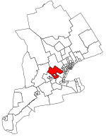
The Halton County Radial Railway is a working museum of electric streetcars, other railway vehicles, buses and trolleybuses. It is operated by the Ontario Electric Railway Historical Association (OERHA). It is focused primarily on the history of the Toronto Transit Commission (TTC) and its predecessor, the Toronto Transportation Commission, Its collection includes PCC, Peter Witt, CLRV and ALRV, and earlier cars from the Toronto streetcar system as well as G-series and M-series Toronto subway cars.The museum is open to the public, with rides on many of its vehicles. It is located between the villages of Rockwood and Campbellville in Milton, Ontario, Canada, along part of the Toronto Suburban Railway's former right-of-way. The tracks conform to the TTC's track gauge of 4 ft 10+7⁄8 in (1,495 mm), which is 60 mm (2+3⁄8 in) wider than 1,435 mm (4 ft 8+1⁄2 in) standard gauge. Vehicles from other systems must be altered to accommodate the tracks, and cars intended for third-rail power must be reconfigured for use with overhead wire. In 1889, electric railway service on routes radiating from Toronto, Ontario began. An Ontario Historical Plaque was erected at the Halton County Radial Railway Museum by the province to commemorate the Radial Railways' role in Ontario's heritage. Museum Peter Witt streetcars can be seen in the 2005 film Cinderella Man on the streets of Toronto to give it a 1930s New York City appearance.

Excerpt from the Wikipedia article Halton County Radial Railway (License: CC BY-SA 3.0, Authors, Images).

Halton County Radial Railway
Guelph Line,

Geographical coordinates (GPS) Address Nearby Places
placeShow on map

Wikipedia: Halton County Radial RailwayContinue reading on Wikipedia

Geographical coordinates (GPS)

Latitude Longitude
N 43.57962 ° E -80.11337 °
placeShow on map

Address

Guelph Line

Ontario, Canada
mapOpen on Google Maps

HCRY PCC Ice Cream Shop
Share experience

Nearby Places

Starkey Hill

Starkey Hill is the highest point in Puslinch Township, southwestern Ontario and is located southeast of Guelph, Ontario. The property is currently owned by the Grand River Conservation Authority and sports a 4 km (2½ mi) loop hiking trail. Parking and access to the trail is located off Arkell Rd., 1 km east of Watson Rd. & the village of Arkell. Starkey Hill is named after the Starkey family who moved to the area in 1833 from the United States and in 1849 purchased 100 acres (40 ha) of land outside of Arkell. In 1911, the Geodetic Survey of Canada created a triangulation station on the Starkey property. The tower was built of wood and stood 100 ft (30 m) with a 36×36 ft (11×11 m) base. The tower was located on the highest point of the property which is also the highest point in Puslinch township. The purpose of the tower was for triangulation surveying. There were hundreds of towers constructed for this purpose in North America. Most of the work was done at night and lamps were placed in towers and sighted from ground locations. The information gathered from this project formed the basis for topographic mapping used today. These towers were not built as permanent structures, and therefore it came down before 1920. The wood from the tower was later used by the Starkey family to build an implement shed. The shed does not stand today. This information was taken from the "Starkey Hill Interpretive Trail" brochure. For more information, contact the Grand River Conservation Authority.