place

Guelph Airport

Registered aerodromes in OntarioTourist attractions in Guelph
Guelph Airpark Aerial

Guelph Airport (TC LID: CNC4) is located in the southeastern part of Guelph/Eramosa at its border with Guelph in Ontario, Canada. It consists of two runways, 14/32 and 06/24. Although known to residents as the "Guelph Airport" or "Guelph Airpark", it is actually an aerodrome, being registered, and not certified, by Transport Canada. The airport is classified as an airport of entry by Nav Canada and is staffed by the Canada Border Services Agency (CBSA) on a call-out basis from the Region of Waterloo International Airport on weekdays and the John C. Munro Hamilton International Airport on weekends. At this airport the CBSA handles general aviation aircraft only, with no more than 15 passengers.Founded in 1954 by aviation enthusiast Len Ariss, the aerodrome remained in the Ariss family until August 2011 when it was sold to Inglis Berry.

Excerpt from the Wikipedia article Guelph Airport (License: CC BY-SA 3.0, Authors, Images).

Guelph Airport
Skyway Drive, Guelph/Eramosa

Geographical coordinates (GPS) Address Nearby Places
placeShow on map

Wikipedia: Guelph AirportContinue reading on Wikipedia

Geographical coordinates (GPS)

Latitude Longitude
N 43.563611111111 ° E -80.195833333333 °
placeShow on map

Address

Guelph Airpark

Skyway Drive
N1L 1P4 Guelph/Eramosa
Ontario, Canada
mapOpen on Google Maps

Guelph Airpark Aerial
Share experience

Nearby Places

University of Guelph Arboretum

The University of Guelph Arboretum was formally established in 1970 by the University of Guelph. The Arboretum aims to conserve biodiversity and connect people with nature through teaching, research, and community outreach. The 165 hectare space serves as an “outdoor learning resource,” a “living laboratory” and a “community resource”. The Arboretum is open all year round to the public from dawn to dusk, and admission is free. It is used for a wide array of purposes such as teaching, research, conservation, recreation, school programs, adult workshops, and walking tours. It is also a popular place for weddings and ceremonies. There are more than 40 collections of woody plants for academic and display purposes, as well as various display gardens, memorial plantings, and facilities. The University of Guelph Arboretum is a member of the American Public Gardens Association and the Society for Ecological Restoration. These memberships and programs allow the Arboretum to work cooperatively towards a variety of biodiversity and conservation goals. Additionally, the Arboretum is one of the 38 Arbnet Level 4 accredited arboretums around the world. The Arboretum and University of Guelph sit on Dish with One Spoon territory, treaty lands of the Mississaugas of the Credit, and the Between the Lakes Treaty 3 lands. Continuing to care for the rich natural heritage of this land in a sustainable manner is part of the Arboretum's vision. It is visited by approximately 100,000 people annually.

University of Guelph

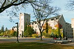
The University of Guelph is a comprehensive public research university in Guelph, Ontario, Canada. It was established in 1964 after the amalgamation of Ontario Agricultural College (1874), the MacDonald Institute (1903), and the Ontario Veterinary College (1922), and has since grown to an institution of almost 30,000 students (including those at the Humber campus, Ridgetown campus, off-campus degree enrolments, diploma enrolments and part-time students) and employs 830 full-time faculty (academic staff) as of fall 2019. It offers 94 undergraduate degrees, 48 graduate programs, and 6 associate degrees in many different disciplines. The veterinary medicine program at the University of Guelph was ranked No. 1 in Canada and No. 5 in the world in 2021. The University of Guelph is ranked No. 4 in Canada in Maclean's "University Rankings 2021" in the Comprehensive category, No. 1 in student satisfaction and No. 1 in research dollars. The university conducts a significant degree of research and offers a wide range of undergraduate, graduate and professional degrees. It is given top marks for student satisfaction among medium-sized universities in Canada by The Globe and Mail. The Ontario Agricultural College is ranked No. 1 in Canada for Agricultural Science, and helps put the University of Guelph 18th in the world for Food Science and Technology. It has held these rankings with its reputation, innovative research-intensive programs, and lively campus life cited as particular strengths. According to the Journal of Hospitality & Tourism Research, the university's Hospitality and Tourism Management program has Canada's highest research index. The University of Guelph has also been ranked 50th by Times Higher Education in its list of the top 100 universities under 50 years old. The university has a key focus on life science and has ranked 76–100 in the world by ARWU. The faculty at the University of Guelph hold 23 Canada Research Chair positions in the research areas of natural sciences, engineering, health sciences and social sciences. Academic achievements include the first scientific validation of water on Mars, Alpha Particle X-ray Spectrometer (APXS) on board the Curiosity rover, and the Barcode of Life project for species identification.

Alumni Stadium (Guelph)

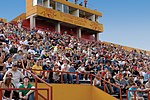
Alumni Stadium is a multi-purpose stadium at the University of Guelph in Guelph, Ontario, Canada. It is home to the Guelph Gryphons varsity football team. It was built in 1970, and has a fixed seating capacity of approximately 8,500, including fixed seating and the grass hill on the east side of the stadium. On October 27, 2011, it was announced that the stadium would undergo an $18 million expansion and renovation that will bring fixed seating capacity up to 7,500. It was also announced that an eight-lane track would be installed as well as synthetic turf for the field. In addition to football the Gryphons soccer teams also play their home games at the stadium. In November 2012, the Hamilton Tiger-Cats announced they had reached a memorandum of understanding with the university to use Alumni Stadium as their temporary home in 2013 while Tim Hortons Field was constructed. The stadium underwent a temporary expansion to accommodate the Canadian Football League team, with seating for approximately 13,000 spectators. The Tiger-Cats played 9 of 10 home games at Alumni Stadium during their 2013 season, including the 2013 East Final against the Montreal Alouettes, which they won in overtime 19–16. The Tiger-Cats went on to be the runners-up of the 101st Grey Cup at Mosaic Stadium at Taylor Field in Regina, Saskatchewan, thus ending their tenure at Alumni Stadium.The $10.5 million, 1,300 m2 (14,000 sq ft) Football Pavilion addition to Alumni Stadium was completed in October 2017. The new facility features a state-of-the-art locker room, players' lounge with kitchen, therapy room with cold and hot tubs, equipment room, coaches offices, meeting rooms and a board room. The two largest meeting rooms and the roof top double as licensed, game-day viewing areas for alumni. This facility also allows for better support to football officials and the visiting teams, as well as being a study area for the players.

RCAF Station Guelph
RCAF Station Guelph

RCAF Station Guelph was a Second World War British Commonwealth Air Training Plan (BCATP) station located in Guelph, Ontario on the campus of the Ontario Agricultural College (OAC), the Ontario Veterinary College (OVC), and the Macdonald Institute. The station is usually known as No. 4 Wireless School and was home to several schools as well as test facilities for air force kitchens. The relationship between the Royal Canadian Air Force and the OAC began in January 1940 when the air force began to send airmen to the OAC to be trained as chefs. This instruction was provided on a contract basis and the OAC remained under the control of the Province of Ontario. In May 1941 the RCAF took control of a large portion of the campus, and by July 1941 a standard RCAF air station was operating there with headquarters in Johnston Hall. The largest school was the Wireless School, which trained airmen to be Wireless Operators. Many moved on to Bombing and Gunnery School to qualify as Wireless Air Gunners. These airmen served as aircrew on large Commonwealth aircraft. Wireless Air Gunners served RAF Bomber Command, perhaps in No. 6 Group RCAF, RAF Coastal Command, and RAF Ferry Command. Those posted to Home Defence in Canada went to RCAF Eastern Air Command or RCAF Western Air Command. This list is not exhaustive. Some airwomen were trained to be Wireless Operator, Ground. The second largest school was the School of Cookery, which trained airmen and airwomen to be chefs in air stations. The British Commonwealth Air Training Plan was a temporary wartime measure scheduled to end on 29 March 1945. In March 1944, Air Minister Power announced that No. 4 Wireless School would close on 29 December 1944. The school actually closed on 12 January 1945, when an air force transition team took over, and on 22 February 1945 the RCAF formally withdrew and returned the campus to the OAC. At least 8,000 airmen and airwomen were trained at RCAF Station Guelph.

Starkey Hill

Starkey Hill is the highest point in Puslinch Township, southwestern Ontario and is located southeast of Guelph, Ontario. The property is currently owned by the Grand River Conservation Authority and sports a 4 km (2½ mi) loop hiking trail. Parking and access to the trail is located off Arkell Rd., 1 km east of Watson Rd. & the village of Arkell. Starkey Hill is named after the Starkey family who moved to the area in 1833 from the United States and in 1849 purchased 100 acres (40 ha) of land outside of Arkell. In 1911, the Geodetic Survey of Canada created a triangulation station on the Starkey property. The tower was built of wood and stood 100 ft (30 m) with a 36×36 ft (11×11 m) base. The tower was located on the highest point of the property which is also the highest point in Puslinch township. The purpose of the tower was for triangulation surveying. There were hundreds of towers constructed for this purpose in North America. Most of the work was done at night and lamps were placed in towers and sighted from ground locations. The information gathered from this project formed the basis for topographic mapping used today. These towers were not built as permanent structures, and therefore it came down before 1920. The wood from the tower was later used by the Starkey family to build an implement shed. The shed does not stand today. This information was taken from the "Starkey Hill Interpretive Trail" brochure. For more information, contact the Grand River Conservation Authority.