Lud's Church
Canyons and gorges of EnglandCaves of StaffordshireLandforms of StaffordshireStaffordshire MoorlandsTourist attractions of the Peak District

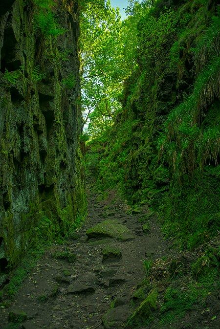
Lud's Church (sometimes written as Ludchurch) is a deep chasm penetrating the Millstone Grit bedrock created by a massive landslip on the hillside above Gradbach, Staffordshire, England. It is located in a wood known as Back Forest, in the Dark Peak, towards the southwest fringe of the Peak District National Park about 2.5 miles (4.0 km) west of the A53 between Leek and Buxton. Over 100 metres (328 ft) long and 18 metres (59 ft) deep, all but the upper third of the slope has slipped forward towards the River Dane. It is mossy and overgrown, wet and cool even on the hottest of days.
Excerpt from the Wikipedia article Lud's Church (License: CC BY-SA 3.0, Authors, Images).Lud's Church
Castor's Bridge, Staffordshire Moorlands Quarnford
Geographical coordinates (GPS) Address External links Nearby Places Show on map
Geographical coordinates (GPS)
| Latitude | Longitude |
|---|---|
| N 53.187777777778 ° | E -2.0205555555556 ° |
Address
Lud's Church
Castor's Bridge
SK11 0BH Staffordshire Moorlands, Quarnford
England, United Kingdom
Open on Google Maps


