Allgreave
Cheshire geography stubsVillages in Cheshire

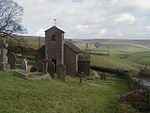
Allgreave is a village in Cheshire, England. It lies on the A54 (Buxton to Congleton) road, near to the border with Staffordshire. Allgreave Methodist Chapel is situated in a sharp bend of the A54. The Rose and Crown public house also stands on the main road.
Excerpt from the Wikipedia article Allgreave (License: CC BY-SA 3.0, Authors, Images).Allgreave
Buxton Road,
Geographical coordinates (GPS) Address Nearby Places Show on map
Geographical coordinates (GPS)
| Latitude | Longitude |
|---|---|
| N 53.2 ° | E -2.042 ° |
Address
Buxton Road
Buxton Road
SK11 0BJ , Macclesfield Forest and Wildboarclough
England, United Kingdom
Open on Google Maps


