Fox Point, Providence, Rhode Island
Cape Verdean American historyIrish-American neighborhoodsNeighborhoods in Providence, Rhode IslandPortuguese-American culture in Rhode IslandPortuguese neighborhoods in the United States

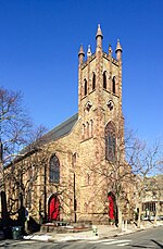
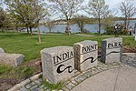
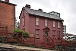
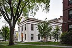
Fox Point is a neighborhood in the East Side of Providence, Rhode Island. It is bounded by the Providence and Seekonk rivers, Interstate 195 and the College Hill and Wayland neighborhoods. Fox Point is the southernmost neighborhood in the East Side area of Providence. Fox Point retains much of its historical character, with housing stock dating from the 18th and 19th centuries in much of the neighborhood. Vernacular interpretations of the Federal, Greek revival, and Italianate architectural styles are well represented West of Governor Street, while somewhat more recent construction dominates on Ives and Gano Streets.
Excerpt from the Wikipedia article Fox Point, Providence, Rhode Island (License: CC BY-SA 3.0, Authors, Images).Fox Point, Providence, Rhode Island
Brook Street, Providence
Geographical coordinates (GPS) Address Nearby Places Show on map
Geographical coordinates (GPS)
| Latitude | Longitude |
|---|---|
| N 41.8191 ° | E -71.398 ° |
Address
Brook Street 99
02903 Providence
Rhode Island, United States
Open on Google Maps


