Green Jacket Shoal

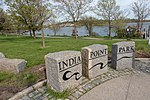
Green Jacket Shoal is a 33-acre (13 ha) shoal and ship graveyard in Providence River, between the cities of East Providence and Providence, Rhode Island, United States. It contains a large amount of debris from a century of abandoned and wrecked ships, destroyed docks, pilings, and other remnants of the area's industrial past. India Point, on the Providence side, was the city's first port, which remained active from 1680 until the Great Depression in the early 20th century. Bold Point, on the East Providence side, was home to a dry dock and other maritime businesses. India Point and Bold Point were later turned into parks. Due to the dangers posed by the debris, as well as the changing character of the cities and increased public recreational use of the parks, a cleanup effort began in 2015 with federal, state, and non-governmental funding. An analysis of the shoal conducted before a cleanup found it to be Rhode Island's largest ship graveyard, with 29 separate vessels having accumulated over the years. The discovery has led marine archaeologists to call for the area's protection as a cultural heritage site.
Excerpt from the Wikipedia article Green Jacket Shoal (License: CC BY-SA 3.0, Authors, Images).Green Jacket Shoal
Portugal Parkway, Providence
Geographical coordinates (GPS) Address Nearby Places Show on map
Geographical coordinates (GPS)
| Latitude | Longitude |
|---|---|
| N 41.814722222222 ° | E -71.394722222222 ° |
Address
Community Boating Center
Portugal Parkway
02906 Providence
Rhode Island, United States
Open on Google Maps


