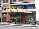
96th Street (Manhattan)

96th Street is a major two-way street on the Upper East Side and Upper West Side sections of the New York City borough of Manhattan. It runs in two major sections: between the FDR Drive and Fifth Avenue on the Upper East Side, and between Central Park West and Henry Hudson Parkway on the Upper West Side. The two segments are connected by the 97th Street transverse across Central Park, which links the disconnected segments of 96th and 97th Streets on each side. 96th Street is one of the 15 hundred-foot-wide (30 m) crosstown streets mapped out in the Commissioner's Plan of 1811 that established the numbered street grid in Manhattan. On Manhattan's West Side, 96th Street is the northern boundary of the New York City steam system, the largest such system in the world, which pumps 30 billion pounds of steam into 100,000 buildings south of the street. (The northern boundary on the East Side is 89th Street.)
Excerpt from the Wikipedia article 96th Street (Manhattan) (License: CC BY-SA 3.0, Authors, Images).96th Street (Manhattan)
West 96th Street, New York Manhattan
Geographical coordinates (GPS) Address Website Nearby Places Show on map
Geographical coordinates (GPS)
| Latitude | Longitude |
|---|---|
| N 40.794051 ° | E -73.970368 ° |
Address
Holy Name of Jesus Church
West 96th Street
10025 New York, Manhattan
New York, United States
Open on Google Maps


