place

Shotesham

AC with 0 elementsCivil parishes in NorfolkShoteshamVillages in Norfolk
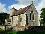
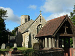
All Saints, Shotesham, Norfolk geograph.org.uk 1279496

Shotesham () is a village in South Norfolk which lies approximately 5 miles south of Norwich. It sits next to Stoke Holy Cross and Saxlingham Nethergate in the valley of the River Tas. It covers an area of 14.50 km2 (5.60 sq mi) and had a population of 539 in 210 households at the 2001 census, increasing to 562 in 227 households at the 2011 census.Shotesham was for many years the Norfolk seat of the D'Oyly family and of the D'Oyly baronets 'of Shottisham', Norfolk (not to be confused with Shottisham, Suffolk), who also possessed estates in Suffolk. The country house and estate of Shotesham Park, designed by Sir John Soane is the seat of the Fellowes family.

Excerpt from the Wikipedia article Shotesham (License: CC BY-SA 3.0, Authors, Images).

Shotesham
Chapel Lane, South Norfolk

Geographical coordinates (GPS) Address Website Nearby Places
placeShow on map

Wikipedia: ShoteshamContinue reading on Wikipedia

Geographical coordinates (GPS)

Latitude Longitude
N 52.543686 ° E 1.321621 °
placeShow on map

Address

R B Copping

Chapel Lane
NR15 1YP South Norfolk
England, United Kingdom
mapOpen on Google Maps

Website
coppingfunerals.co.uk

linkVisit website

All Saints, Shotesham, Norfolk geograph.org.uk 1279496
Share experience

Nearby Places

Poringland
Poringland

Poringland is a village in the district of South Norfolk, England. It lies 5 miles (8.0 km) south of Norwich city centre and 10 miles (16 km) north of Bungay. Its population has rapidly grown in the past 50 years. It covers an area of 6.32 km2 (2.44 sq mi) and had a population of 3,261 living in 1,403 households at the 2001 census, the population increasing to 3,802 at the 2011 Census.Poringland was previously also known as both East Poringland and Great Poringland, and was part of the ancient Hundred of Henstead. The place-name 'Poringland' is first attested in the Domesday Book of 1086, where it appears as 'Porringhelanda', the meaning of which is uncertain. Some believe the name derives from 'Poor spring land', because it has poor soil, containing much clay. This village contains many public services. These include two pubs, a supermarket, estate agents, takeaways, a restaurant and various shops. The church of Poringland All Saints is one of 124 existing round-tower churches in Norfolk. The village sign, which stands close to the church and the village pond, depicts the artist John Crome, founder of the Norwich School of artists, working on his famous painting 'The Poringland Oak'. Cromes Oak Close in the village is named after the artist. Many of Crome's paintings are available to view at the Norwich Castle Museum. The original of the Poringland Oak hangs in Room 7 at Tate Britain. The village of Framingham Earl which borders Poringland, contains the local High School. The River Chet (Norfolk) rises in Poringland. The German writer W.G. Sebald lived in Poringland until his death in a car crash in 2001. A former Norwich City and Scotland international footballer Robert Fleck also lived in Poringland. Ronan Parke, runner-up of Britain's Got Talent in 2011, also resides in the village. As does former Norwich City and Everton manager, Mike Walker.

Caistor St Edmund
Caistor St Edmund

Caistor St Edmund is a village and former civil parish on the River Tas, now in the parish of Caistor St Edmund and Bixley, South Norfolk, England. The parish covered an area of 6.55 square kilometres (2.53 sq mi) and had a population of 270 in 116 households at the 2001 census, the population increasing to 289 at the 2011 Census. On the 1st of April 2019 the parish was merged with Bixley to form Caistor St Edmund and Bixley.The remains of a Roman market town and capital of the Iceni tribe, Venta Icenorum, are nearby (British National Grid ref TG230034). The ruins are in the care of the Norfolk Archaeological Trust and managed by South Norfolk Council. It is assumed that the Roman 'Stone Street' runs from Dunwich on the Suffolk coast to Caistor St Edmund. The parish church of St Edmund's lies at the south-east corner of the old Roman town. Caistor St Edmund features on the Antonine Itinerary, a Roman "road map" of the routes around Britain. The villages name means 'Roman site'. The church is dedicated to St. Edmund hence that addition to distinguish it from Caister-on-Sea. Caistor Old Hall was built in 1612 for Thomas Pettus. During the 19th century it was owned by John Spurrell (son of William Spurrell, of Thurgarton, Norfolk). The River Tas passes under Markshall bridge, just north of the Roman camp, and then flows on towards Arminghall and Trowse. The village has one hotel, Caistor Hall Hotel, a fine example of Georgian building constructed between 1795 and 1797 by the Dashwood family. The actual site can be traced back even further to before the Norman Conquest and originally belonged to the Abbey at Bury St Edmunds until it was confiscated during the Dissolution of the Monasteries. Caistor Manor and land then passed to the Godslave family who owned it until the early 1600s and then in turn to the Pettus family. Through marriage the land became the property of the Dashwoods in 1793. The first recorded owner was Horatio Dashwood who lived in the hall with his wife Harriet and their children.

Framingham Earl
Framingham Earl

Framingham Earl is a small village situated south of Norwich, in the English county of Norfolk. It is next to Poringland and Framingham Pigot. It covers an area of 2.56 km2 (0.99 sq mi) and had a population of 834 in 354 households at the 2001 census, increasing to a population of 871 in 363 households at the 2011 Census. The villages name means 'Homestead/village of Fram's people'. The village was held by the Earl of Norfolk hence the 'Earl' addition. Within Framingham Earl is Framingham Earl High School, which is part of the Sapientia Education Trust. Sharing the same site is a Sports Centre, which opened in early 2006 and provides a range of exercise classes and sports opportunities to the people of the surrounding villages as well as giving the school extra space to use for PE and dance lessons. It is now managed by South Norfolk District Council. [1] The village has two churches, the Methodist Church and the Church of St. Andrew′s. St. Andrew's is one of 124 existing round-tower churches in Norfolk. The plan of the church is beguilingly irregular, with the chancel decreasing in width towards the east end. A pilaster strip in the south wall of the chancel curiously tapers with the narrow portion at the bottom: the whole building has a gnarled, irregular appearance which is a mark of Anglo-Saxon construction. Even the corners (quoins) are of flint, although these are somewhat larger on the whole than those built into the body of the walls. There is even, surprisingly, an attempt at herringbone-work, all in flint, and round splayed porthole windows dressed entirely in flints, not quite perfect circles. The German writer W. G. Sebald is buried in the churchyard of St. Andrew's.