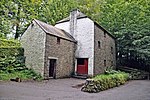
Michaelston-super-Ely
Glamorgan geography stubsVillages in Cardiff

Michaelston-super-Ely is a village, to the west of the city of Cardiff, Wales. Its Welsh name is Llanfihangel-ar-Elai (where llan church + Mihangel Saint Michael + Elai River Ely). It is approximately half a mile from the boundary with the Vale of Glamorgan. To the north lies the village of St Fagans, and to the east the Ely estate. The community of Michaelston-super-Ely was joined with St Fagans in 1968.The historic St Michael's Church was decommissioned in 2010. It is a Grade II* listed building dating from the late 12th or early 13th-century.
Excerpt from the Wikipedia article Michaelston-super-Ely (License: CC BY-SA 3.0, Authors, Images).Michaelston-super-Ely
Michaelston Road, Cardiff Ely
Geographical coordinates (GPS) Address Nearby Places Show on map
Geographical coordinates (GPS)
| Latitude | Longitude |
|---|---|
| N 51.476 ° | E -3.27 ° |
Address
Michaelston Road
Michaelston Road
CF5 4TG Cardiff, Ely
Wales, United Kingdom
Open on Google Maps


