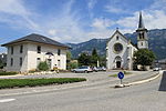
Leysse
Auvergne-Rhône-Alpes geography stubsChambéryFrance river stubsRivers of Auvergne-Rhône-AlpesRivers of France ... and 2 more
Rivers of SavoieTributaries of the Rhône

The Leysse is the river which crosses the city of Chambéry, Savoie, France. At its entrance into the city, it goes underground in a channel of about one kilometer.
Excerpt from the Wikipedia article Leysse (License: CC BY-SA 3.0, Authors, Images).Leysse
Boulevard Ernest Coudurier, Chambéry
Geographical coordinates (GPS) Address Phone number Nearby Places Show on map
Geographical coordinates (GPS)
| Latitude | Longitude |
|---|---|
| N 45.6558 ° | E 5.8673 ° |
Address
Camping de l'Île aux Cygnes
Boulevard Ernest Coudurier 501
73370 Chambéry
Auvergne-Rhône-Alpes, France
Open on Google Maps


