place

Col du Chat

Climbs in cycle racing in FranceLandforms of SavoieMountain passes of FranceMountain passes of the JuraMountains of France
Col du Chat 638m
Col du Chat 638m

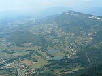
The Col du Chat is a mountain pass located in France, in the commune of La Chapelle-du-Mont-du-Chat, in the French department of Savoie in the Auvergne-Rhône-Alpes region. It crosses the Mont du Chat in the Jura Mountains, overlooking Lac du Bourget opposite the town of Aix-les-Bains. Although it has never been crossed by a main transalpine route, the pass has been crossed by a road since ancient times, and its use has often gone beyond the strictly local, at least until the Chat tunnel was opened: Montaigne, for example, used it on his way back from Italy. Today, it is used mainly by tourists, as a climb for cyclists, or as a starting point for hikes to Mont du Chat. Because of the region's particular flora and fauna, the pass is located within the perimeter of and close to natural zones of ecological, faunal and floristic interest and Natura 2000 reserves. The pass is open all year round, with no winter shutdowns.

Excerpt from the Wikipedia article Col du Chat (License: CC BY-SA 3.0, Authors, Images).

Col du Chat
Route du Col du Chat, Chambéry

Geographical coordinates (GPS) Address Nearby Places
placeShow on map

Wikipedia: Col du ChatContinue reading on Wikipedia

Geographical coordinates (GPS)

Latitude Longitude
N 45.692777777778 ° E 5.8472222222222 °
placeShow on map

Address

Route du Col du Chat

Route du Col du Chat
73370 Chambéry
Auvergne-Rhône-Alpes, France
mapOpen on Google Maps

Col du Chat 638m
Col du Chat 638m
Share experience

Nearby Places

Lac du Bourget
Lac du Bourget

Lac du Bourget (French: [lak dy buʁʒɛ]; English Lake Bourget), also locally known as Lac Gris ([lak gʁi]; English: Grey Lake) or Lac d'Aix ([lak d‿ɛ]), is a lake at the southernmost end of the Jura Mountains in the department of Savoie, France. It is the deepest lake located entirely within France, and either the largest or second largest after Lac de Grand-Lieu depending on season.The largest town on its shore is Aix-les-Bains. Chambéry, the capital of Savoie, lies about 10 km south of the lake. The lake is mainly fed by the river Leysse (and other small rivers), and it drains towards the river Rhône through the Canal de Savières, an artificial channel. It is a Ramsar site. The extinct bezoule was found only in this lake. The lake was formed during the last period of global glaciation in the Alps (Würm glaciation) during the Pleistocene epoch. It has a surface area of 44.5 square kilometres (4,450 hectares). The long and narrow north-south axis of the lake extends 18 km in length, and ranges between 1.6 km and 3.5 km in width. The lake's average depth is 85 m, and its maximum depth in 145 m. The lake is meromictic. Unlike ordinary lakes, its deep water does not mix annually with water closer to the surface.The lake is bordered by the steep summits of the Mont du Chat and the Chaîne de l'Épine on the west, and Bauges Mountains on the east, which form its shores. Lac du Bourget was made famous by several romantic poems of Alphonse de Lamartine, including Le Lac, as well as by descriptions by Xavier de Maistre, Honoré de Balzac, and Alexandre Dumas.