place

Horsford

AC with 0 elementsBroadlandCivil parishes in NorfolkHorsfordUse British English from July 2013
Villages in Norfolk
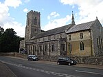
Horsfordchurch
Horsfordchurch

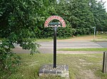
Horsford is a village six miles north of Norwich, England which is surrounded by the Horsford Forest and is named after the dried up section of the River Hor. Its population has seen a steady increase since the Second World War, growing from 750 in 1945 to 4,163 at the 2011 Census. There are various explanations of the village name. It is usually said to derive from 'horse ford', but it has also been suggested that it comes from the River Hor on which the village stands (more usually known to locals as 'the Beck'). A third explanation is that it comes from Horsa, the name of a Saxon chief. The surrounding Horsford Forest has been designated a County Wildlife Site. The rare silver-studded blue butterfly has a colony in this forest. The motte of the demolished Horsford Castle lies to the east of the village.

Excerpt from the Wikipedia article Horsford (License: CC BY-SA 3.0, Authors, Images).

Horsford
Meadow Way, Broadland

Geographical coordinates (GPS) Address Nearby Places
placeShow on map

Wikipedia: HorsfordContinue reading on Wikipedia

Geographical coordinates (GPS)

Latitude Longitude
N 52.7007 ° E 1.2412 °
placeShow on map

Address

Meadow Way

Meadow Way
NR10 3SD Broadland
England, United Kingdom
mapOpen on Google Maps

Horsfordchurch
Horsfordchurch
Share experience

Nearby Places

Horsham St Faith
Horsham St Faith

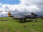
Horsham St Faith is a village in Norfolk, England. The village lies close and to the east of the A140 road and is 5 miles (8.0 km) north of Norwich and some 8 miles (12.9 km) south of Aylsham It takes its name from the River Hor, which runs through it on its way from Horsford to Horstead; and a Benedictine priory, founded in honour of St Faith that, until the dissolution of the monasteries, stood there. It is near Norwich International Airport, which began in 1939 as RAF Horsham St Faith and home of the City of Norwich Aviation Museum. Administratively it is in the civil parish of Horsham St Faith and Newton St Faith within the district of Broadland. It also forms part the wider Norwich Built-up area. The name 'Horsham' means 'horse homestead/village'. It has the remains of a Horsford Castle, a motte and bailey castle, on the Horsford side of the A140 road, reached by following a track to the north of Church Street, which joins Horsford and Horsham St Faith. On 17 October from the early 12th century until 1872 it played host to one of the country's largest cattle fairs. This fair was held to the south of Spixworth Road around Bullock Hill and Calf Lane.At the beginning of the 20th century, the Manor House and the land that in 1939 became RAF Horsham St Faith, was owned by John Thomas Spurrell, youngest son of Richard James Spurrell, of Thurgarton. Inside the church at Horsham St Faith there is a memorial to his eldest son, John Francis Brabazon Spurrell, who was killed by buffalo at Kibaya, Tanganyika, in 1927.