place

Flamborough railway station

1847 establishments in EnglandDisused railway stations in the East Riding of YorkshireFormer York and North Midland Railway stationsGeorge Townsend Andrews railway stationsGrade II listed buildings in the East Riding of Yorkshire
Grade II listed railway stationsPages with no open date in Infobox stationRailway stations in Great Britain closed in 1970Railway stations in Great Britain opened in 1847Use British English from December 2016
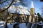
Flamborough former station geograph 3520082 by Ben Brooksbank

Flamborough railway station was located in the village of Marton, and was originally named after that location. However, there were several other railway stations also called Marton, so on 1 July 1884 the North Eastern Railway renamed it after the village of Flamborough several miles away. It was situated on the Yorkshire Coast Line from Scarborough to Hull and was opened on 20 October 1847 by the York and North Midland Railway. The station was 33 miles (53 km) north of Hull, and 17 miles (27 km) south of Seamer railway station.

Excerpt from the Wikipedia article Flamborough railway station (License: CC BY-SA 3.0, Authors, Images).

Flamborough railway station
Jewison Lane,

Geographical coordinates (GPS) Address Nearby Places
placeShow on map

Wikipedia: Flamborough railway stationContinue reading on Wikipedia

Geographical coordinates (GPS)

Latitude Longitude
N 54.112619 ° E -0.171 °
placeShow on map

Address

The Poplars Caravan Park

Jewison Lane 45
YO15 1DX
England, United Kingdom
mapOpen on Google Maps

Flamborough former station geograph 3520082 by Ben Brooksbank
Share experience

Nearby Places

Gypsey Race
Gypsey Race

The Gypsey Race is a winterbourne stream that rises to the east of Wharram-le-Street and flows through the villages of Duggleby, Kirby Grindalythe, West Lutton, East Lutton, Helperthorpe, Weaverthorpe, Butterwick, Foxholes, Wold Newton, Burton Fleming, Rudston and Boynton. The stream flows into the North Sea in Bridlington harbour. It is the most northerly of the Yorkshire chalk streams.The Gypsey Race rises in the Great Wold Valley through a series of springs and flows intermittently between Duggleby and West Lutton where it runs underground in the chalk aquifer before re-surfacing in Rudston. It has been known during very wet conditions for the stream to re-appear at Wold Newton some 4.3 miles (7 km) north west of Rudston. Water from the aquifer running between West Lutton and Wold Newton also heads south to re-appear at Elmswell feeding West Beck and the River Hull.According to folklore, when the Gypsey Race is flowing in flood (The Woe Waters), bad fortune is at hand. It was in flood in the year before the great plague of 1664, the restoration of Charles II (1660) and the landing of William of Orange (1688), before the two world wars and the bad winters of 1947 and 1962.The stream also badly flooded the village of Burton Fleming in 2012 when the water was 2 feet (0.61 m) deep in places.Villagers in Boynton have an annual duck race on the stream in May. Hundreds of yellow plastic ducks are paid for and race the Race in aid of funds for the village hall.