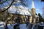
Bempton
AC with 0 elementsCivil parishes in the East Riding of YorkshireOpenDomesdayUse British English from November 2014Villages in the East Riding of Yorkshire

Bempton is a village and civil parish in the East Riding of Yorkshire, England, near the border with North Yorkshire. It is near the North Sea coast and Flamborough Head, and is situated about 4 miles (6.4 km) north of Bridlington. It lies on the B1229 road between Speeton and Flamborough. It is served by Bempton railway station which is on the Yorkshire Coast Line that runs between Hull and Scarborough. The parish of Bempton also contains Buckton village, which is situated directly next to Bempton. According to the 2011 UK census, Bempton parish had a population of 1,040, a slight decrease on the 2001 UK census figure of 1,050.
Excerpt from the Wikipedia article Bempton (License: CC BY-SA 3.0, Authors, Images).Bempton
St Michael's Walk,
Geographical coordinates (GPS) Address Nearby Places Show on map
Geographical coordinates (GPS)
| Latitude | Longitude |
|---|---|
| N 54.1317 ° | E -0.1772 ° |
Address
St Michael's Walk
St Michael's Walk
YO15 1HE , Bempton
England, United Kingdom
Open on Google Maps


