place

Sewerby Hall

1720 establishments in EnglandAC with 0 elementsArt museums and galleries in the East Riding of YorkshireAviariesBridlington
Country houses in the East Riding of YorkshireGardens in the East Riding of YorkshireGrade I listed buildings in the East Riding of YorkshireGrade I listed housesHistory museums in the East Riding of YorkshireHouses completed in 1720Museums in the East Riding of YorkshireUse British English from September 2019Zoos in England
Sewerby Hall
Sewerby Hall

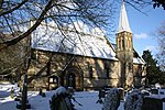
Sewerby Hall (also known as Sewerby House) is a Grade I listed Georgian country house set in 50 acres (20 ha) of landscaped gardens in the village of Sewerby, 2 miles (3.2 km) from the seaside town of Bridlington in the East Riding of Yorkshire, England. The main block was built circa 1714, incorporating some older work, in 3 storeys in brick with a seven window frontage. In 1808, 2-storey bow fronted wings and a semi-circular Doric portico were added and the whole building painted to resemble stone. The wings were later raised to 3 storeys.

Excerpt from the Wikipedia article Sewerby Hall (License: CC BY-SA 3.0, Authors, Images).

Sewerby Hall
Church Lane,

Geographical coordinates (GPS) Address Nearby Places
placeShow on map

Wikipedia: Sewerby HallContinue reading on Wikipedia

Geographical coordinates (GPS)

Latitude Longitude
N 54.10336 ° E -0.16095 °
placeShow on map

Address

Sewerby Hall

Church Lane
YO15 1EA
England, United Kingdom
mapOpen on Google Maps

Sewerby Hall
Sewerby Hall
Share experience

Nearby Places

Gypsey Race
Gypsey Race

The Gypsey Race is a winterbourne stream that rises to the east of Wharram-le-Street and flows through the villages of Duggleby, Kirby Grindalythe, West Lutton, East Lutton, Helperthorpe, Weaverthorpe, Butterwick, Foxholes, Wold Newton, Burton Fleming, Rudston and Boynton. The stream flows into the North Sea in Bridlington harbour. It is the most northerly of the Yorkshire chalk streams.The Gypsey Race rises in the Great Wold Valley through a series of springs and flows intermittently between Duggleby and West Lutton where it runs underground in the chalk aquifer before re-surfacing in Rudston. It has been known during very wet conditions for the stream to re-appear at Wold Newton some 4.3 miles (7 km) north west of Rudston. Water from the aquifer running between West Lutton and Wold Newton also heads south to re-appear at Elmswell feeding West Beck and the River Hull.According to folklore, when the Gypsey Race is flowing in flood (The Woe Waters), bad fortune is at hand. It was in flood in the year before the great plague of 1664, the restoration of Charles II (1660) and the landing of William of Orange (1688), before the two world wars and the bad winters of 1947 and 1962.The stream also badly flooded the village of Burton Fleming in 2012 when the water was 2 feet (0.61 m) deep in places.Villagers in Boynton have an annual duck race on the stream in May. Hundreds of yellow plastic ducks are paid for and race the Race in aid of funds for the village hall.

Flamborough
Flamborough

Flamborough is a village and civil parish in the East Riding of Yorkshire, England. It is situated approximately 4 miles (6 km) north-east of Bridlington town centre on the prominent coastal feature of Flamborough Head. The most prominent man-made feature of the area is Flamborough Head Lighthouse. The headland extends into the North Sea by approximately 6 miles (10 km). To the north, the chalk cliffs stand at up to 400 feet (120 m) high. For information about its founding, see Thorgils Skarthi. According to the 2011 UK Census, Flamborough parish had a population of 2,161, an increase on the 2001 UK Census figure of 2,121.The church of St Oswald stands in the village and was designated a Grade II* listed building in 1966 and is now recorded in the National Heritage List for England, maintained by Historic England. The village centre contains a number of shops and public houses. The Old Dog and Duck is at Dog and Duck Square. In the village are the fragmentary remains of Flamborough Castle, a medieval fortified manor house. In 1823 the village was a parish in the Wapentake of Dickering. Flamborough was recorded as "merely a fishing village" with a "very ancient station, formerly of some note". The population at the time was 917, half of which constituted the families of fishermen. Occupations included eleven farmers, two blacksmiths, two butchers, two grocers, seven carpenters, four shoemakers, three tailors, a stonemason & flour dealer, a bacon & flour dealer, a weaver, a corn miller, a straw hat manufacturer, and the landlords of the Sloop, the Board and the Dog and Duck public houses. Also listed was a schoolmaster and a gentlewoman. Four carriers operated in the village, destinations being Hull and York twice a week, and Bridlington, daily. With St Oswald's Church was a Methodist and a Primitive Methodist chapel.Between 1894 and 1974 Flamborough was a part of the Bridlington Rural District, in the East Riding of Yorkshire. Between 1974 and 1996 it was part of the Borough of North Wolds (later Borough of East Yorkshire), in the county of Humberside. According to local legend, the village is haunted by the ghost of a suicide known as Jenny Gallows. Flamborough, with its holiday camps and a caravan park, is a holiday destination during the summer months. The village holds an annual Fire Festival on New Year's Eve which in 2017 attracted 5,000 people.In 2018 the beach at Flamborough was used in the filming of the ITV drama Victoria.