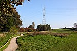
Stalmine
Geography of the Borough of WyreThe FyldeUse British English from April 2015Villages in Lancashire

Stalmine is a village in the civil parish of Stalmine-with-Staynall, in the Wyre borough of Lancashire, England, in a part of the Fylde known as Over Wyre. The village is located on a small hill on the A588, the main road between Hambleton and Lancaster, with the highest level 75 ft above sea level. The village name has been spelled Stalmin (in 1205) and Stalemynne (in 1278). The village had a population of 1,087 at the 2011 Census.
Excerpt from the Wikipedia article Stalmine (License: CC BY-SA 3.0, Authors, Images).Stalmine
Hall Gate Lane, Borough of Wyre Stalmine-with-Staynall
Geographical coordinates (GPS) Address Nearby Places Show on map
Geographical coordinates (GPS)
| Latitude | Longitude |
|---|---|
| N 53.902 ° | E -2.956 ° |
Address
Hall Gate Lane
FY6 0LA Borough of Wyre, Stalmine-with-Staynall
England, United Kingdom
Open on Google Maps


