place

Wyre Estuary Country Park

1991 establishments in EnglandCountry parks in LancashireGeography of the Borough of WyreTourist attractions in the Borough of Wyre
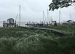
Footpath in the Wyre Estuary Country Park geograph.org.uk 2173909

Wyre Estuary Country Park is located in Thornton-Cleveleys, Lancashire, England. Established in 1991 and covering 0.79 acres (0.32 ha), it is situated on the western banks of the 28 miles (45 km) long River Wyre, near its mouth at the Irish Sea at Fleetwood. The Wyre estuary forms part of the southern boundary of Morecambe Bay. From the park's car park, Fleetwood can be viewed to the north, and there are also vistas across the river to South Lakeland to the northeast, Over Wyre to the east and, beyond, the Bowland Fells.It has received a Green Flag Award and a VisitEngland Award.The park is a starting point on the Wyre Way.

Excerpt from the Wikipedia article Wyre Estuary Country Park (License: CC BY-SA 3.0, Authors, Images).

Wyre Estuary Country Park
River Road, Borough of Wyre Stanah

Geographical coordinates (GPS) Address Nearby Places
placeShow on map

Wikipedia: Wyre Estuary Country ParkContinue reading on Wikipedia

Geographical coordinates (GPS)

Latitude Longitude
N 53.8799 ° E -2.9796 °
placeShow on map

Address

River Road
FY5 5FA Borough of Wyre, Stanah
England, United Kingdom
mapOpen on Google Maps

Footpath in the Wyre Estuary Country Park geograph.org.uk 2173909
Share experience

Nearby Places

Thornton–Cleveleys railway station

Thornton–Cleveleys (originally simply named Cleveleys) was a railway station in England which served the Lancashire village of Thornton and town of Cleveleys. Located on the now disused line between Poulton-le-Fylde and Fleetwood, the station also had a shunting yard for the making-up of freight trains for Preston and beyond. During its life it was also known at times as Thornton station and Thornton for Cleveleys station. In the 1860s and early 1870s the line was of great importance, being the direct route from London to Glasgow. Before the Shap route was opened, passengers (allegedly including Queen Victoria) would travel from Euston to Fleetwood and then onwards via steamer to Scotland. The original station was opened in April 1865, and was named Cleveleys. It was to the south of Station Road in Thornton, near an older halt called Ramper Road. The Station Master's house and station building can still be seen in use as a private residence. The station was renamed Thornton for Cleveleys on 1 April 1905. This station closed in 1927 when the new station (the first to be built by the LMS) opened to the north of the level crossing. In February 1953, the station was renamed again, this time to Thornton–Cleveleys. Rationalised in the 1950s and 1960s, and affected by the ending of the ferry from Fleetwood to the Isle of Man, the station eventually closed on 1 June 1970, when the Fleetwood line was closed to passengers. Freight continued on the line to nearby Burn Naze until 1999.