Stalmine-with-Staynall
Civil parishes in LancashireGeography of the Borough of WyreThe FyldeUse British English from December 2021

Stalmine-with-Staynall is a civil parish within the Wyre borough of Lancashire, England, in a part of the Fylde known as Over Wyre. The parish contains the village of Stalmine and the hamlets of Staynall and Wardley. The civil parish had a population of 1,486 at the 2011 Census, of which 1,087 lived in Stalmine village.Located close to the Irish Sea coast, the Wyre Estuary forms the parish's western boundary. The highest point is only approximately 75 feet (23 m) above sea level. The parish adjoins the Wyre parishes of Fleetwood, Preesall, Pilling, Out Rawcliffe, Hambleton and the Thornton area which is unparished.
Excerpt from the Wikipedia article Stalmine-with-Staynall (License: CC BY-SA 3.0, Authors, Images).Stalmine-with-Staynall
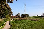
Grange Lane, Borough of Wyre Stalmine-with-Staynall
Geographical coordinates (GPS) Address Nearby Places Show on map
Geographical coordinates (GPS)
| Latitude | Longitude |
|---|---|
| N 53.899 ° | E -2.959 ° |
Address
Grange Lane
Grange Lane
FY6 0JQ Borough of Wyre, Stalmine-with-Staynall
England, United Kingdom
Open on Google Maps


