place

Hillylaid Pool

England river stubsLancashire geography stubsRivers of the Borough of FyldeRivers of the Borough of WyreThe Fylde
Wyre catchment
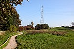
Urban Small Stream Emerges geograph.org.uk 1157056

Hillylaid Pool is a water channel running through the Fylde and Wyre areas of Lancashire in England. It is 4.55 miles (7.32 km) long, and it is part of the Fleetwood Peninsula Tributary catchment area.Hillylaid Pool joins the River Wyre at Stanah, shortly after merging with another watercourse to the northwest of Flint's Caravan Park.It has the ability to be pumped at high tide by a pumping station on River Road, beside the entrance to Wyre Estuary Country Park.It was the subject of Wyre River Trust's Hillylaid Pool Wetland Project in 2018. The wetlands were created on the banks of the Wyre at Stanah in 2020, a combined effort of The Rivers Trust and Wyre Rivers Trust.

Excerpt from the Wikipedia article Hillylaid Pool (License: CC BY-SA 3.0, Authors, Images).

Hillylaid Pool
River Road, Borough of Wyre Stanah

Geographical coordinates (GPS) Address Nearby Places
placeShow on map

Wikipedia: Hillylaid PoolContinue reading on Wikipedia

Geographical coordinates (GPS)

Latitude Longitude
N 53.8815 ° E -2.978 °
placeShow on map

Address

River Road
FY5 5FA Borough of Wyre, Stanah
England, United Kingdom
mapOpen on Google Maps

Urban Small Stream Emerges geograph.org.uk 1157056
Share experience

Nearby Places

ICI Hillhouse
ICI Hillhouse

ICI Hillhouse was a chlorine-production facility in Lancashire, England. A division of Imperial Chemical Industries (ICI), it was active between 1941 and 1992. Its triangular footprint spread from the banks of the River Wyre at Stanah in the east, to Hillylaid Road in the southwest, to the southern edge of Fleetwood in the north. Its entrances were on Hillylaid Road (via the extant gate at the end of today's The Hawthorns) and on Butts Road in Burn Naze. Burn Naze Halt railway station served those arriving by train. ICI Hillhouse expanded on a United Alkali Company venture begun in 1890. ICI General Chemical Divisions purchased the assets of Hillhouse and Burn Hall Works from the Ministry of Supply. A power plant was built on today's Bourne Way in 1958, providing ICI with electricity and steam power. A railway line—part of the Fleetwood branch line—was built to connect Burn Naze to Poulton-le-Fylde and beyond. The line still exists today, although the sidings at Burn Naze were removed after all freight traffic ceased in 1999. Water from the Lancaster Canal, beside Nateby Hall bridge, was extracted by ICI Hillhouse via a 25-year lease. Around 6,000 megalitres (1.3 million gallons) of water was obtained. The boreholes the facility previously used resulted in the water turning brackish due to a fault line which runs between Barrow-in-Furness and the Fylde. ICI Hillhouse closed in 1992, after which the Burn Naze area, where most of the workers lived, subsequently suffered a downturn in fortunes. The chlorine plant was demolished in 1994. The power station was demolished in 2007; its chimney followed on 7 November 2009. In 1999, Glasgow-based NPL Estates reached a £50 million agreement with ICI to create new housing, leisure, supermarket and shopping facilities on the Burn Naze portion of the land. Another section became the Hillhouse Enterprise Zone. A plaque beside the Thornton-Cleveleys War Memorial at Four Lane Ends honours ICI Hillhouse workers who served in the first and second World Wars. Poulton & Wyre Railway Society have placed a plaque honouring the wars' soldiers at Burn Naze Halt.

Thornton–Cleveleys railway station

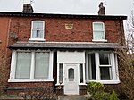
Thornton–Cleveleys (originally simply named Cleveleys) was a railway station in England which served the Lancashire village of Thornton and town of Cleveleys. Located on the now disused line between Poulton-le-Fylde and Fleetwood, the station also had a shunting yard for the making-up of freight trains for Preston and beyond. During its life it was also known at times as Thornton station and Thornton for Cleveleys station. In the 1860s and early 1870s the line was of great importance, being the direct route from London to Glasgow. Before the Shap route was opened, passengers (allegedly including Queen Victoria) would travel from Euston to Fleetwood and then onwards via steamer to Scotland. The original station was opened in April 1865, and was named Cleveleys. It was to the south of Station Road in Thornton, near an older halt called Ramper Road. The Station Master's house and station building can still be seen in use as a private residence. The station was renamed Thornton for Cleveleys on 1 April 1905. This station closed in 1927 when the new station (the first to be built by the LMS) opened to the north of the level crossing. In February 1953, the station was renamed again, this time to Thornton–Cleveleys. Rationalised in the 1950s and 1960s, and affected by the ending of the ferry from Fleetwood to the Isle of Man, the station eventually closed on 1 June 1970, when the Fleetwood line was closed to passengers. Freight continued on the line to nearby Burn Naze until 1999.