place

Our Lady of Guadalupe Church & International Shrine of St. Jude

1826 establishments in Louisiana19th-century Roman Catholic church buildings in the United StatesAfrican-American Roman Catholic churchesAfrican-American Roman CatholicismLouisiana Voodoo
Roman Catholic churches completed in 1826Roman Catholic churches in New OrleansRoman Catholic national shrines in the United States
RampartOurLadyOfGuadalupeNoonOct07

Our Lady of Guadalupe Church & International Shrine of St. Jude is a Roman Catholic church located on Rampart Street in New Orleans, Louisiana. It is the oldest surviving church building in the city (originally established as the Chapel of St. Anthony of Padua), the back of the church is bordered by Basin Street, and the parish is predominantly African-American. The church is one of multiple parishes in the city that celebrates a weekly "Gospel Jazz Mass" on Sunday mornings.

Excerpt from the Wikipedia article Our Lady of Guadalupe Church & International Shrine of St. Jude (License: CC BY-SA 3.0, Authors, Images).

Our Lady of Guadalupe Church & International Shrine of St. Jude
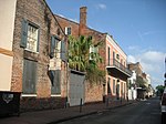
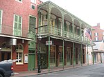
North Rampart Street, New Orleans Storyville

Geographical coordinates (GPS) Address Phone number Website Nearby Places
placeShow on map

Wikipedia: Our Lady of Guadalupe Church & International Shrine of St. JudeContinue reading on Wikipedia

Geographical coordinates (GPS)

Latitude Longitude
N 29.9585 ° E -90.0707 °
placeShow on map

Address

Our Lady of Guadalupe Church

North Rampart Street 411
70112 New Orleans, Storyville
Louisiana, United States
mapOpen on Google Maps

Phone number

call+15045251551

Website
judeshrine.com

linkVisit website

RampartOurLadyOfGuadalupeNoonOct07
Share experience

Nearby Places

Basin Street
Basin Street

Basin Street or Rue Bassin in French, is a street in New Orleans, Louisiana. It parallels Rampart Street one block lakeside, or inland, from the boundary of the French Quarter, running from Canal Street down 5 blocks past Saint Louis Cemetery. It currently then turns lakewards, flowing into Orleans Avenue. The name comes from the turning basin of the Carondelet Canal formerly located on the street, where it now turns on to Orleans by the Municipal Auditorium. In the late 19th century and early 20th century railroad tracks paralleled the Canal and then turned on to Basin Street, running up the "neutral ground" (as street medians are called locally) to one of the city's main railroad depots on Canal Street. At one time one of the finest residential streets in the city, it became a red light district around 1870. From 1897 through World War I, the back side of Basin Street was the front of the Storyville red light district, with a line of high end saloons and mansions devoted to music.After Storyville's closure, Basin Street was temporarily renamed North Saratoga. The majority of Storyville was demolished and replaced with the Iberville Projects. Basin Street formerly continued on the other side of Canal Street to Common Street, today known as Elk Place, which after two blocks becomes Loyola Avenue on the upper side of Common Street. The equivalent street paralleling Rampart one block back on the other side of Louis Armstrong Park in the Treme neighborhood is Saint Claude. There is a series of monuments on the neutral ground of Basin Street, including statues of Simón Bolívar, Benito Juárez, and Francisco Morazán, and a metal sign commemorating Storyville.

Canal Street, New Orleans

Canal Street (French: rue du canal) is a major thoroughfare in the city of New Orleans. Forming the upriver boundary of the city's oldest neighborhood, the French Quarter or Vieux Carré, it served historically as the dividing line between the colonial-era (18th-century) city and the newer American Sector, today's Central Business District. Up until the early 1800s, it was the Creoles who lived in the Vieux Carré. After the Louisiana Purchase (1803), a large influx of other cultures began to find their way into the city via the Mississippi River. A number of Americans from Kentucky and the Midwest moved into the city and settled uptown. Along the division between these two cultures, a canal was planned. The canal was never built but the street which took its place received the name. Furthermore, the median of the street became known as the neutral ground, acknowledging the cultural divide. To this day, all medians of New Orleans streets are called neutral grounds.One end of Canal Street terminates at the Mississippi River. Often called "the foot of Canal Street", at the riverfront the Canal Street Ferry offers a connection to the Algiers Point neighborhood, an older, 18th-century portion of the larger Algiers section of New Orleans. Canal Street's other terminus is in Mid-City at a collection of cemeteries. Slightly offset from the Mid-City end is the beginning of Canal Boulevard, which extends to the shore of Lake Pontchartrain via the Lakeview neighborhood. Throughout its length, Canal, which runs east and west, serves as a dividing line for cross streets running north and south; although the New Orleans layout follows the Mississippi River. The street has three lanes of traffic in both directions, with a pair of streetcar tracks in the center. Canal Street's downtown segment serves as the hub of the city's public transit system or RTA, with numerous streetcar and bus route terminals. (Of note, it is the home of the Canal Streetcar Line, operated by the RTA.) Canal Street is often said to be the widest roadway in America to have been called a street, instead of the avenue or boulevard titles more typically appended to wide urban thoroughfares.