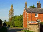
Pattishall
Civil parishes in NorthamptonshireUse British English from March 2014Villages in NorthamptonshireWest Northamptonshire District

Pattishall, also known in antiquity as Pateshull, is a village and Parish in West Northamptonshire, England. The population of the civil parish (including Astcote, Dalscote and Eastcote) was 1,471 at the 2011 census. The village lies adjacent to the Roman road Watling Street (A5) and Banbury Lane, an ancient drove way, 4 miles north of Towcester and 7 miles south of Northampton. The civil parish of Pattishall includes the villages of Pattishall, Eastcote, Astcote and Dalscote, part of Fosters Booth, and the hamlet of Cornhillin Eastcote).
Excerpt from the Wikipedia article Pattishall (License: CC BY-SA 3.0, Authors, Images).Pattishall
Church Street,
Geographical coordinates (GPS) Address Nearby Places Show on map
Geographical coordinates (GPS)
| Latitude | Longitude |
|---|---|
| N 52.182421 ° | E -1.019295 ° |
Address
Church Street
Church Street
NN12 8NB
England, United Kingdom
Open on Google Maps


