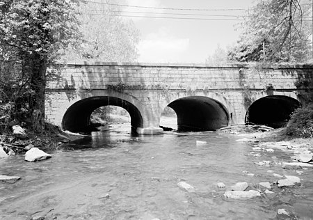
Powell Creek (Pennsylvania)
Dauphin County, Pennsylvania geography stubsPennsylvania river stubsRivers of Dauphin County, PennsylvaniaRivers of PennsylvaniaTributaries of the Susquehanna River

Powell Creek (on federal maps since 2004: Powells Creek) is a 16.5-mile-long (26.6 km) tributary of the Susquehanna River in Dauphin County, Pennsylvania in the United States.It is formed by the junction of its North and South forks southwest of Carsonville. The creek flows southwest along the northern side of Peters Mountain. Powell Creek joins the Susquehanna River just upstream of the Clarks Ferry Bridge and the borough of Duncannon.Powell Creek and nearby Powells Valley was named for the Powell family who settled near its banks in about 1760.
Excerpt from the Wikipedia article Powell Creek (Pennsylvania) (License: CC BY-SA 3.0, Authors, Images).Powell Creek (Pennsylvania)
South River Road, Reed Township
Geographical coordinates (GPS) Address Nearby Places Show on map
Geographical coordinates (GPS)
| Latitude | Longitude |
|---|---|
| N 40.410277777778 ° | E -76.984444444444 ° |
Address
Bridge in Reed Township
South River Road
17032 Reed Township
Pennsylvania, United States
Open on Google Maps


