place

Carholme, Lincoln

Areas of Lincoln, EnglandPolitics of Lincoln, EnglandRiver WithamWards of Lincolnshire
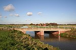
The junction between Carholme Road and Brayford Way, Lincoln geograph.org.uk 6652355

Carholme is an inner-city ward of Lincoln in Lincolnshire, England. The population of the City of Lincoln ward at the 2021 census was 11,227. The ward is one of the eleven electoral districts within the City of Lincoln Council.

Excerpt from the Wikipedia article Carholme, Lincoln (License: CC BY-SA 3.0, Authors, Images).

Carholme, Lincoln
Wellington Street, Lincoln New Boultham

Geographical coordinates (GPS) Address Nearby Places
placeShow on map

Wikipedia: Carholme, LincolnContinue reading on Wikipedia

Geographical coordinates (GPS)

Latitude Longitude
N 53.232874 ° E -0.553718 °
placeShow on map

Address

Wellington Street

Wellington Street
LN1 1QA Lincoln, New Boultham
England, United Kingdom
mapOpen on Google Maps

The junction between Carholme Road and Brayford Way, Lincoln geograph.org.uk 6652355
Share experience

Nearby Places

River Till, Lincolnshire

The River Till is a river in the county of Lincolnshire in England and is ultimately a tributary of the River Witham. Its upper reaches drain the land east of Gainsborough. The middle section is embanked, as the water level is higher than that of the surrounding land, and pumping stations pump water from low level drainage ditches into the river. Its lower reaches from the hamlet of Odder near Saxilby into the city of Lincoln were canalised, possibly as early as Roman times, as part of the Foss Dyke.Much of the channel is managed by the Environment Agency as it is classified as a main river, while the upper river and the land drainage ditches which border the river are managed by the Upper Witham internal drainage board. In order the help protect the city of Lincoln from flooding, a sluice has been built across the channel at the Till Washlands site. When flooding is a possibility, the sluice is closed, and other sluices allow the surrounding farmland to be inundated until water levels start to fall again. The defences were first used in 2000, and successfully prevented flood damage in Lincoln in the summer of 2007. There are issues with water quality on much of the river, caused by run-off from agricultural land, physical modification of the river channel, and discharges from sewage treatment works. In 2011, a stretch of the river near Saxilby was affected by the invasive aquatic fern Azolla. An environmental project to control the fern saw some 8,000 Azolla weevils (Stenopelmus rufinasus) released into the river. As they feed exclusively on the fern, once the fern has been consumed they die out naturally without affecting native species.

Lincoln Racecourse
Lincoln Racecourse

Lincoln Racecourse is a former horse racing venue to the west of the city of Lincoln, at Carholme, a flat tract of common land in Lincolnshire, England. It was the original location of the Lincolnshire Handicap. The course closed in 1964, and the following year the race relocated to Doncaster Racecourse where a small change to the race title sees it run as the Lincoln Handicap. The track's history was long and significant. James I himself acted as Clerk of the Course there in 1607. He is recorded as requesting that a 450 yards long stretch of the course be "raled and corded with ropes and hoopes" on both sides, so that the horses "that ronned were seen fayre."The Flat racing season usually opened with the three day Spring meeting in March, with the Lincolnshire Handicap on the third day. This race was probably run for the first time on 10 August 1849, over a distance of two miles, and won by a filly, Media, owned by Lord Exeter. Media won another race later in the day. The distance of the Lincoln was reduced to one mile on the straight course in 1864 or 1865. John Rickman describes the Lincoln mile as "easy", as it was slightly downhill for the first two furlongs, with a very-slight left handed elbow before half way. This gave horses drawn with low numbers a disadvantage. The course was a left-handed oval of about one mile, five furlongs, with a home straight of about half a mile.From 1727 at the earliest, Lincoln had held a Royal Plate race, run in 4 mile heats by 6 year olds carrying 12 stone.The course was located west of the City of Lincoln by Saxilby Road. The racecourse was established by the Lincoln Corporation on West Common in 1773. The grandstand of 1897 is a Grade II listed building, now used as a community centre. The A57 road passed between the course and the grandstand. During race meetings, this was closed off and traffic diverted, enabling BBC cameras to follow the leaders of the race at close distance all the way from start to the winning post. After closure the course was used for many years as a Point to Point track.