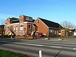
Zoutkamp
Fishing communitiesHet HogelandPages with Dutch IPAPages with Gronings IPAPopulated places in Groningen (province)

Zoutkamp (Dutch pronunciation: [ˈzʌutkɑmp]; Gronings: Zoltkamp [ˈzɔːɫtkɑmp]) is a village in the municipality Het Hogeland which is part of the province Groningen in the Netherlands. The village started as a sconce. During the Dutch Revolt, it was the site of the Battle of Zoutkamp. Later it became a fishing village. The harbour was moved to Lauwersoog in 1969 as a result of the closure of the Lauwersmeer, and is nowadays used for recreational purposes. The economy of the village mainly depends on fishing.
Excerpt from the Wikipedia article Zoutkamp (License: CC BY-SA 3.0, Authors, Images).Zoutkamp
Wilhelminastraat, Het Hogeland
Geographical coordinates (GPS) Address Nearby Places Show on map
Geographical coordinates (GPS)
| Latitude | Longitude |
|---|---|
| N 53.3375 ° | E 6.3030555555556 ° |
Address
Wilhelminastraat 1
9974 SG Het Hogeland
Groningen, Netherlands
Open on Google Maps


